Pictures from Arizona
Arizona is also known as the Grand Canyon State, and it is understandable once you visit the place. We entered the state via Hoover Dam and drove through Kingman and Seligman to Williams. From there, we took the Grand Canyon Railway to the canyon. After the visit, we continued to Flagstaff, and then we drove north through the Navajo Reservation to Utah.
In 2010 we visited a lot of thne same places, as Dorte and I had already visited in 2006, but we alkso wnt down to southern Arizona and visited Tombstone and the Saguaro National Park. Later we visited the Petrified Forest National Park, Grand Canyon and Sunset Crater National Monument.
Click on a picture for full size.
|
Pictures from 2010 |
|
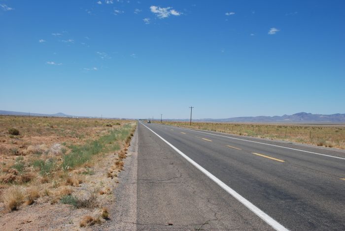 |
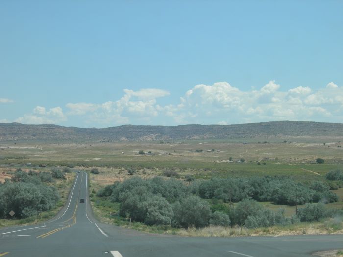
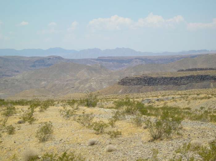
We entered Arizona from Nevada via the Hoover Dam. After a lunch in the town of Kingman, we started out on America's most famous road (I think), Route 66 Here we are just outside of Kingman, which can still be seen in the distance. |
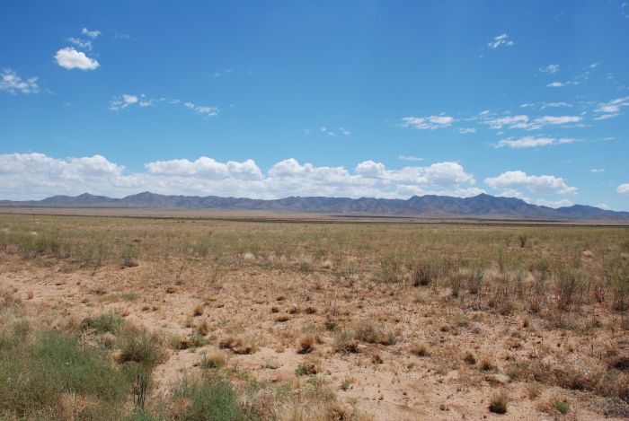 |
In the opposite direction you can see the mountains (the Grand Wash Cliffs) in the distance. |
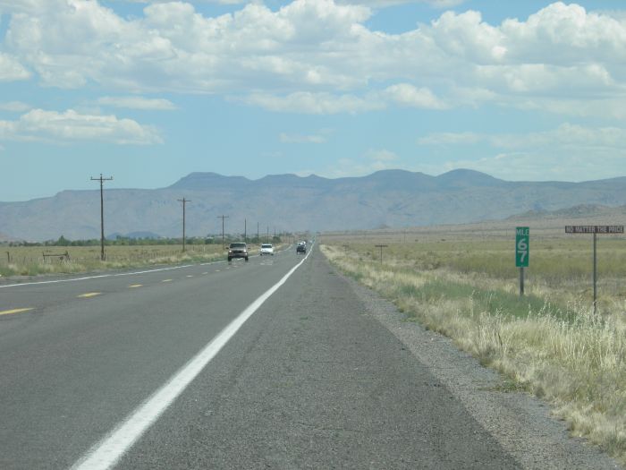 |
Closer to the mountains, the traffic got heavy :-) At the side of the road Burma Shave signs, |
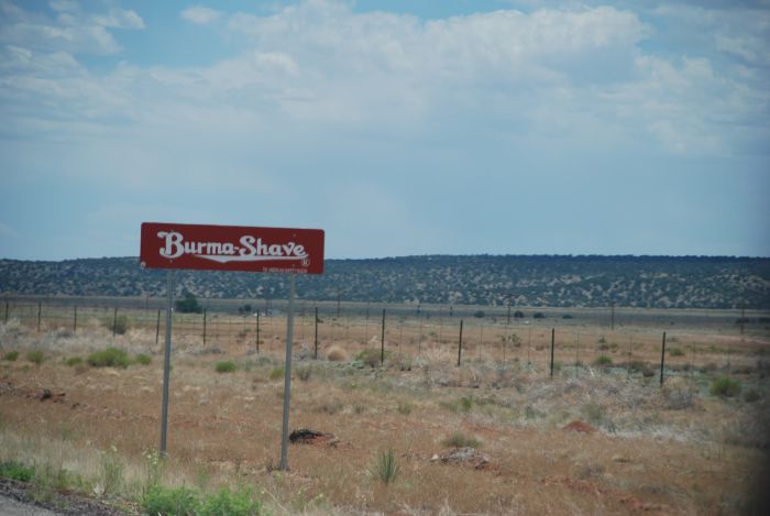 |
Another Burma Shave sign. |
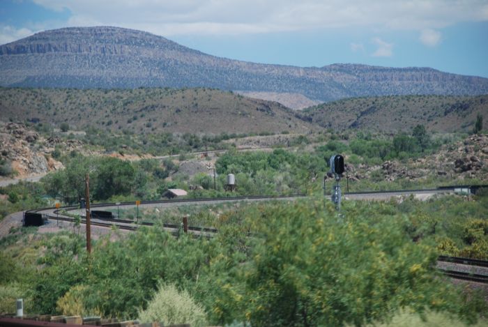 |
The railway runs close to the road at this part of Route 66. |
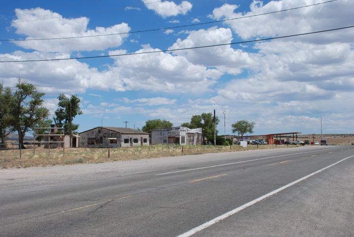 |
Not all the service stations along Route 66 have been shined up. |
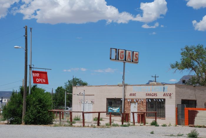 |
Some are worn down and others are closed. |
 |
Entering the Hualapai reservation. |
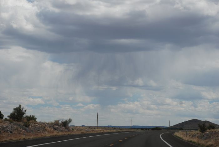 |
In spite of heavy clouds, we saw no rain - yet. |
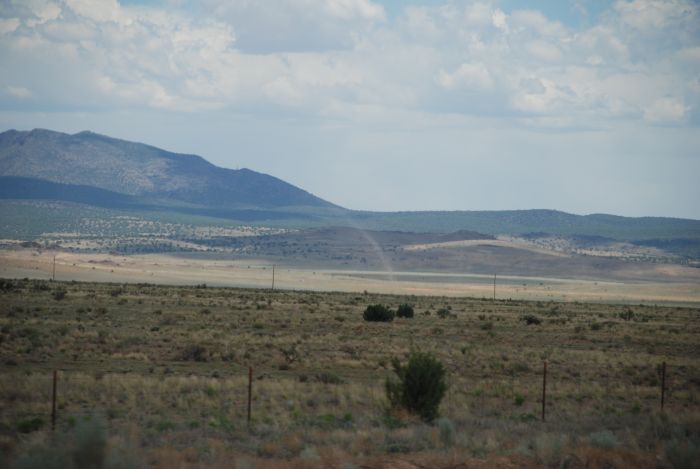 |
But a lot of dust devils. |
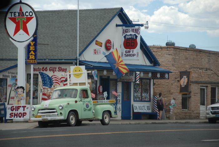 |
Seligman has preserved the style of Route 66's heyday in the fifthies. This is Angel and Vilma's Gift Shop. |
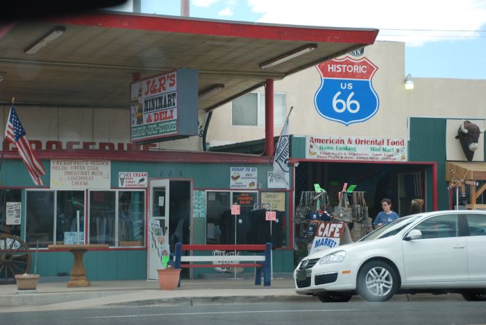 |
And J & R's Minimart and Deli! |
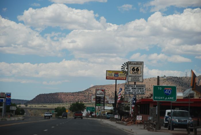 |
Leaving town we passed Roadkill Cafe, offering buffalo burgers. We tried buffalo burgers, but not until we got to Wyoming. |
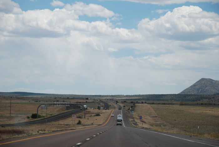 |
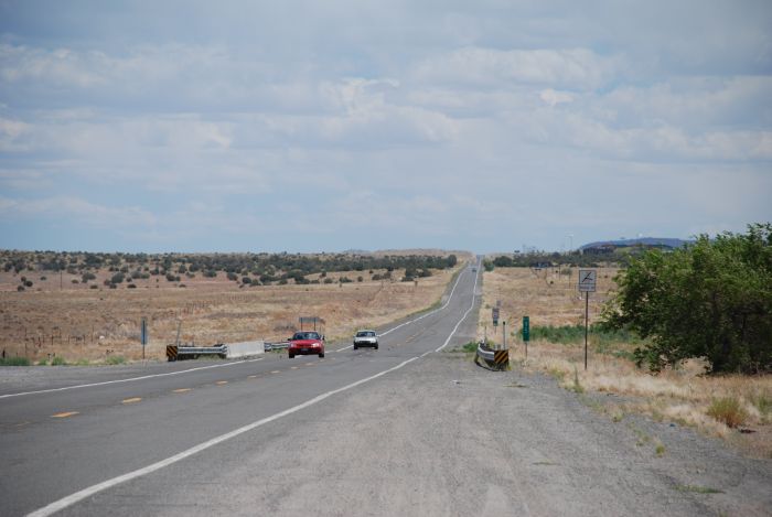
Going east on Interstate Highway 40. |
 |
And heading south on I-17 after a long stretch on U.S. Route 89. |
 |
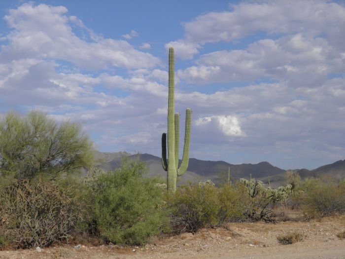
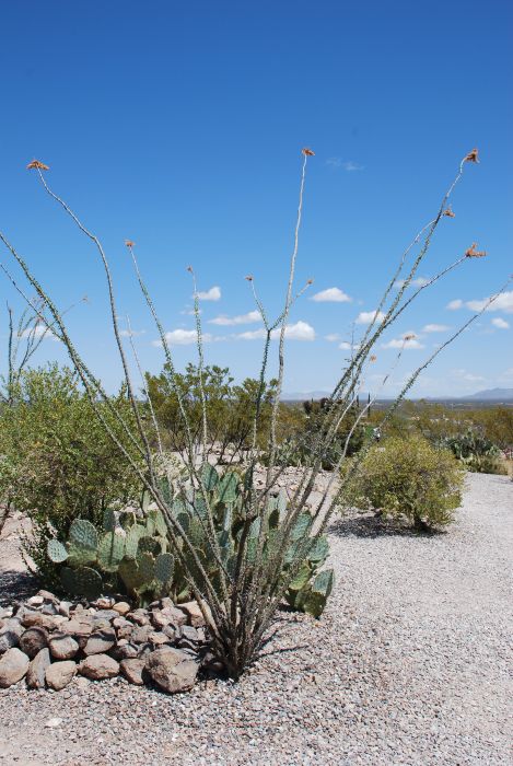
And entering cacti country. |
 |
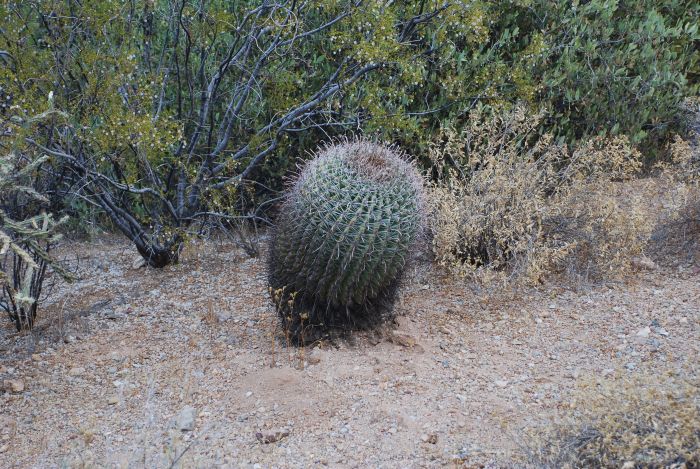
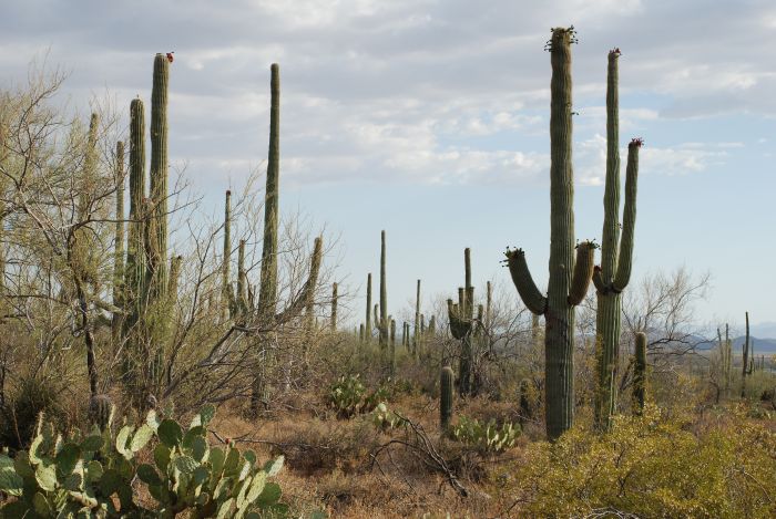
To be sure to see some big cacti, we visited Saguaro National Park. |
 |
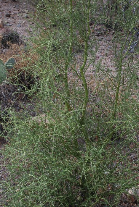
On our way to the park's visitor center we saw several species of cacti. |
 |
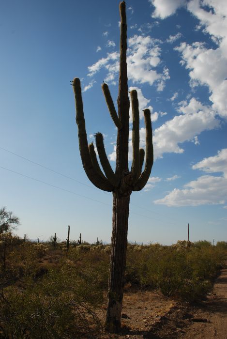
The park's name origins from the big saguaro cactus. A proctected species. |
 |
These cacti starts as a single stem and only when they are between 50 and 75 years old, branches appears. |
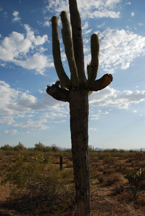 |
The saguaro can get more than 30 feet tall and live for about 150 years. The largest known saguaro is almost 45 feet and 30 feet around. |
 |
I don't know how tall this was, but it was tall. |
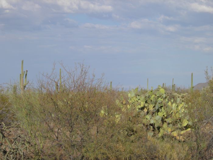 |
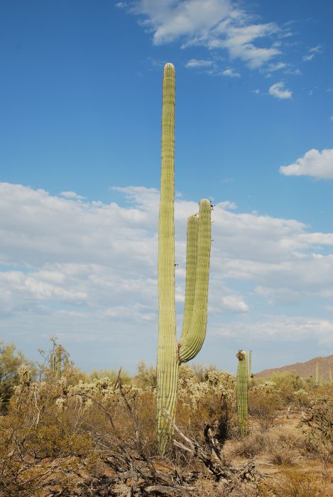
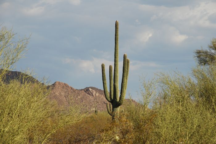
Of course the saguaroa are most impressive, but there are many other nice cacti in the park. |
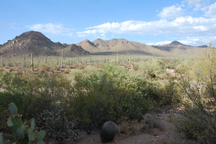 |
But once again the saguarosa dominate the landscape. |
 |
Here is another type. I don't know the name or the species of this one, but then I'm not a cacti expert. |
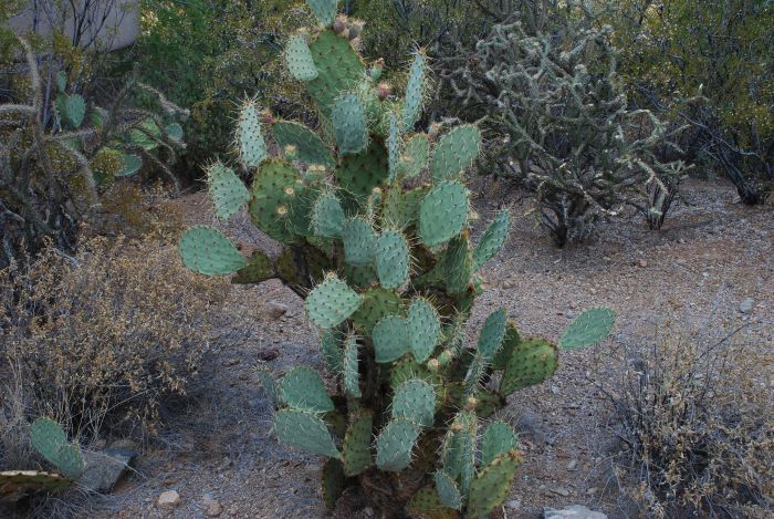 |
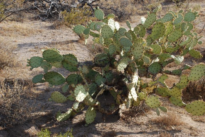
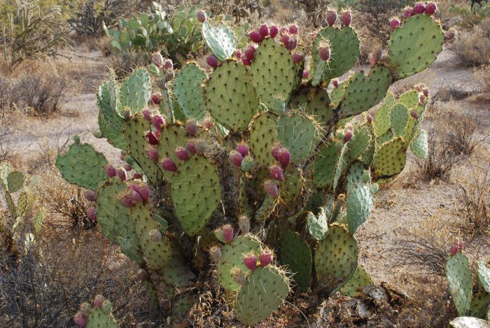
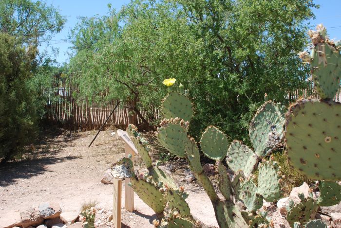
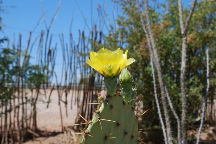
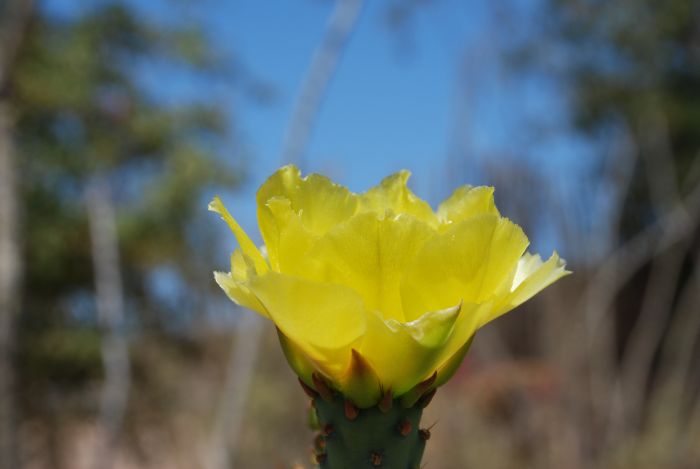
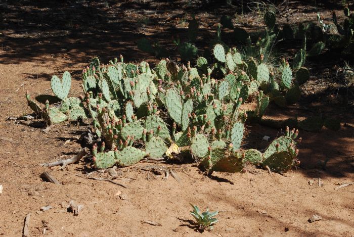
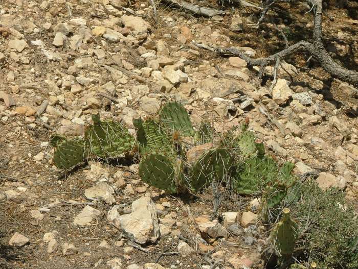
This one I do know though. It's called a Prickly Pear. |
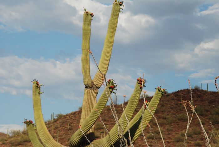 |
The saguaros are blooming between April and June, so that had passed when we visited but we saw their big red fruits. |
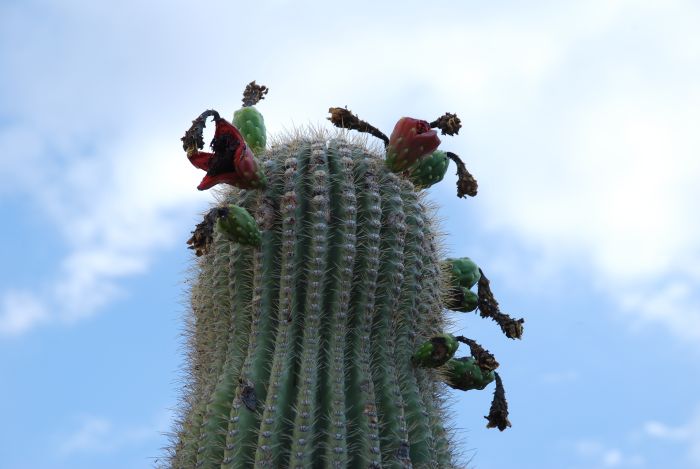 |
Close up of the fruits. They are edible and the locals loves them. |
 |
Another unknown (at least to me) cactus. |
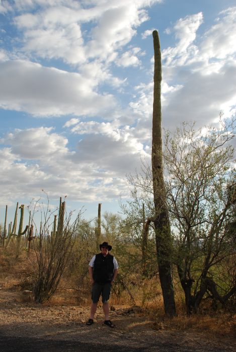 |
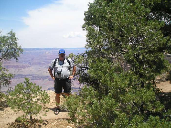
Tim next to a saguaro. He is 6'5" (without the hat) and that gives an impression of the size of the catus. |
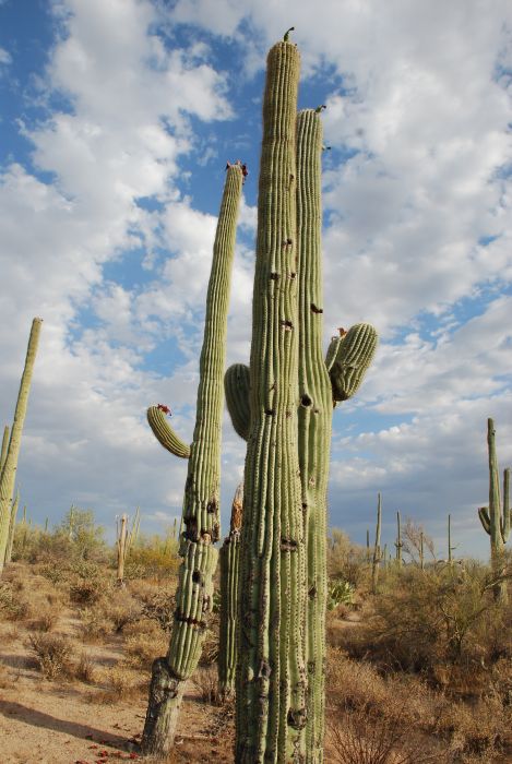 |
When the cacti get older, they dry up from the inside. This is used by birds, that nest in the hollow cacti |
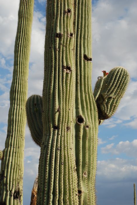 |
A bird entered one of the holes just before I took this picture, but it refused to leave, while we were waiting, so no bird this time. |
 |
Another prickly pear. |
 |
And the final picture from Saguro National Park. But don't you worry; more cacti will appear later. |
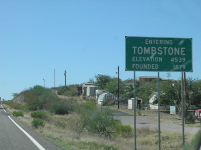 |
Next stop in southern Arizona was Tombstone. |
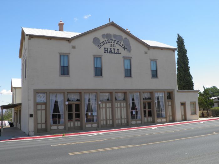 |
This is Schieffelin Hall in Tombstone. The house was built in 1881 by Al Schieffelin, brother of Tombstone's founder, Ed Schieffelin. The South West's then largest adobe building served as an opera house. The opera house had room for 600 spectators. On 18th of March 1882 brothers Wyatt and Morgan Earp were among the audience just before Morgan Earp was shot in revenge for the OK Corral shoot out. |
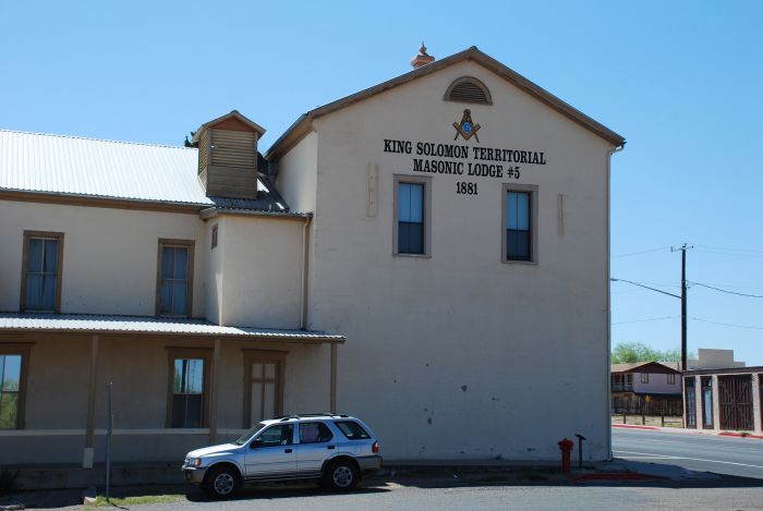 |
Today the building houses King Solomon Masonic Lodge #5, one of the five original masonic lodges in Arizona. |
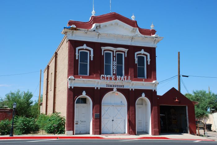 |
Close by you find the old town hall. |
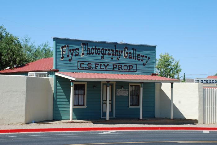 |
And on the opposite side of Fremont Street you find Camillus Fly's Photography Gallery. |
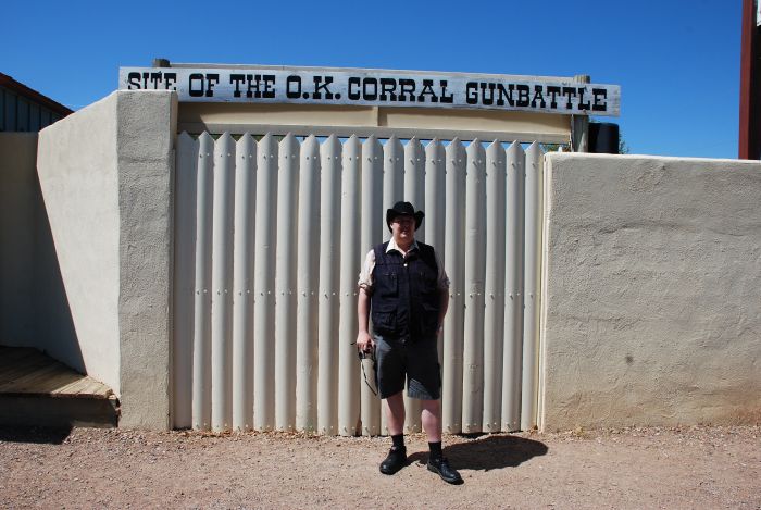 |
Next door to Fly is the O.K. Corral. Actually the original O.K. Corral was further down the street. Next to Fly's shop was an empty lot, and it was in this lot that the most famous shootout of the old west took place. |
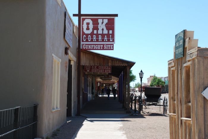 |
Today you have to pay and admission fee to enter. It was only 10 AM and we didn't want to wait to see a reenactment of the shootout at two PM, so we just took a walk. |
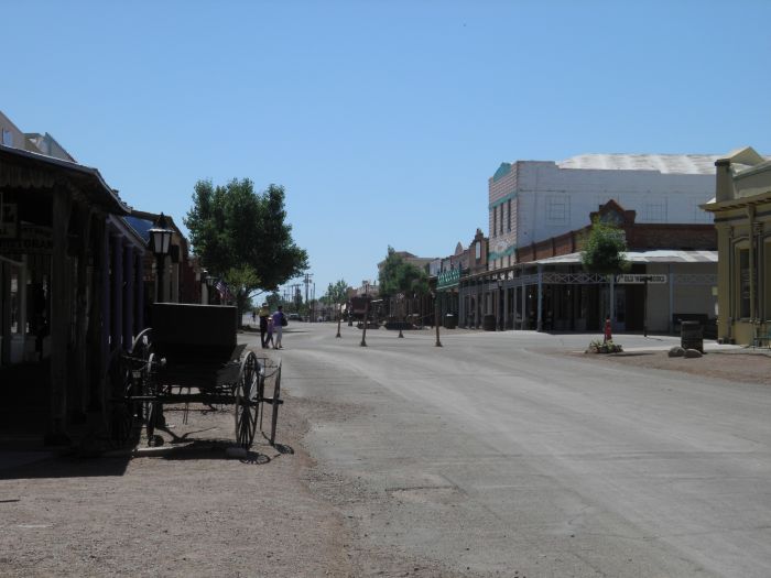 |
Mainstreet in historic Tombstone. |
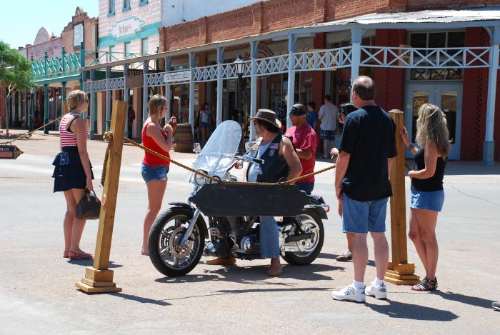 |
On mainstreet we met this guy driving around with a parrot on his motorcycle. Some spectators had their picture taken with the bird like the girl in the red blouse and denim shorts. As Tim suffers from ornithophobia to some degree, we just took some photos of other people with the bird. |
 |
The historic district in Tombsatone is still a western town with false facades and elevated sidewalks. |
 |
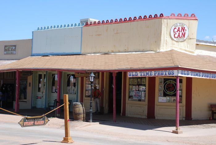
The town is extremely "touristy". |
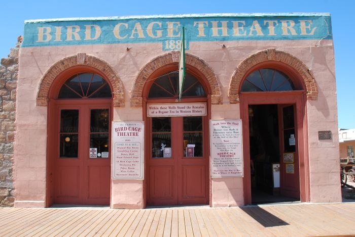 |
The old theatre |
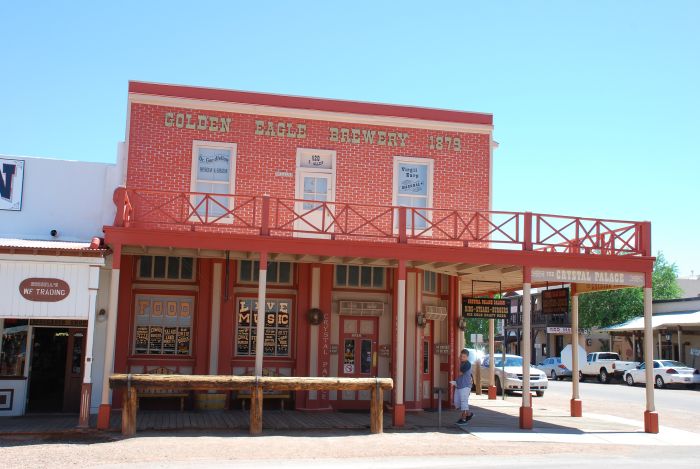 |
And a brewery |
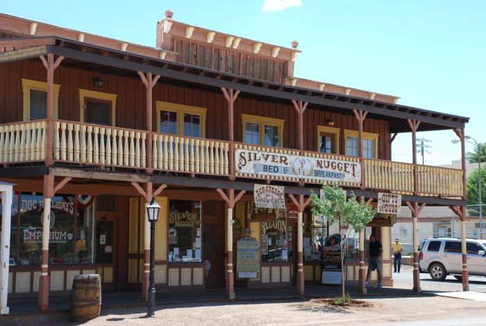 |
And quite a number of saloons. |
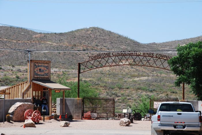 |
And a mine. The guy at the entrance, was very eager to sells us tickets for a visit to the mine. |
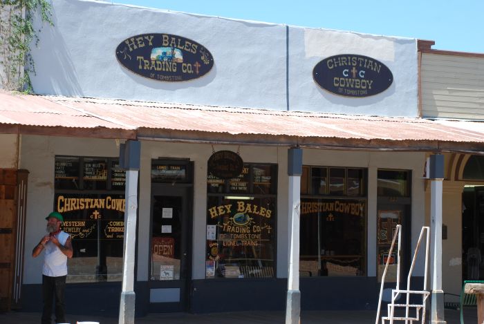 |
There is also a General Store in town. |
 |
And Big Nose Kate's Saloon. Big Nose Kate was Doc Holiday's girlfriend and she actually didn't own a saloon ran a boarding house. |
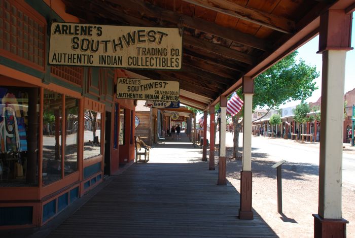 |
A last glimpse of the sidewalks. |
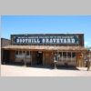 |
Then we drove to the famous Boot Hill Graveyard. |
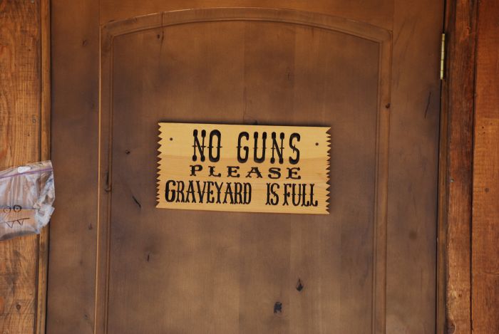 |
A very good advice. |
 |
The graveyard is known for its headstones, made of wood. Some with shorter or longer inscriptions. Her is the grave of Dutch Annie, who died in 1883. |
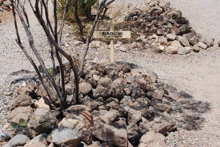 |
And Ben Olleny, was killed by Chinoon. |
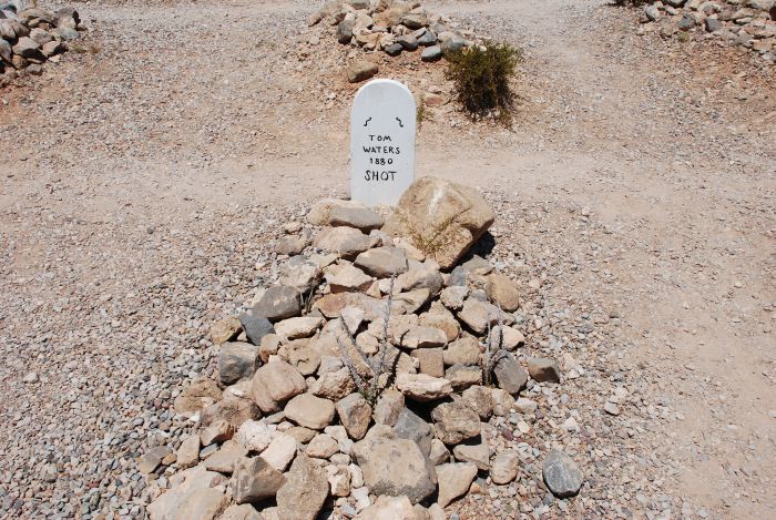 |
Tom Waters, shot in 1880. |
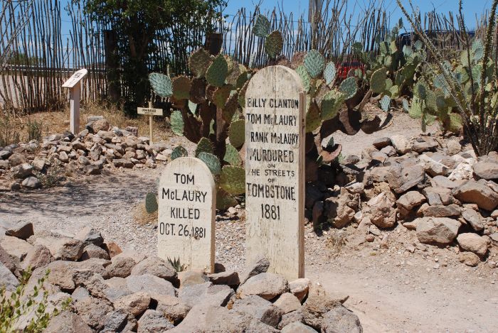 |
And a memorial for the three that was killed in the OK Corral shootout, Tom and Frank McLaury and Bill Clanton. |
 |
Before continuing the tour around the graveyard, we enjoyed the view of the surrounding landscape. |
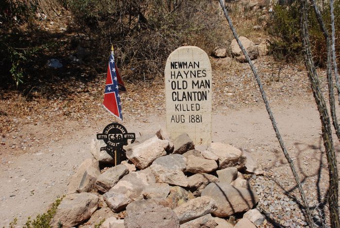 |
The grave of Newman Haynes Clanton, called "Old Man". He was the father of four sons, among which Billy og Ike took part in the O.K. Corral shootout. Ike was later killed in a duel and daddy was killed by mexicans, probaly as revenge for a duel in connection with cattle rustling. |
 |
Not everybody died from bullet wounds. Dan Dowd was hung. |
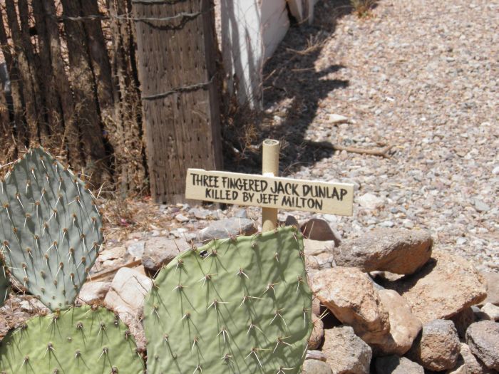 |
And "Three-finger Jack" was killed by Jeff Milton. |
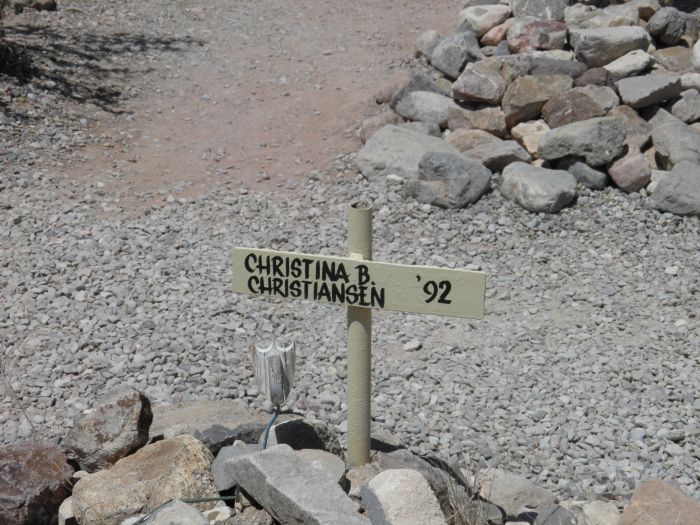 |
How Christina B. Christiansen died is not mentioned, but her name sounds Danish. |
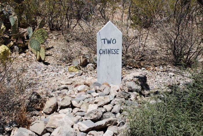 |
Some of the buried are unknwon today like these two chinese. |
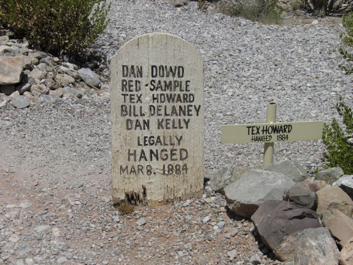 |
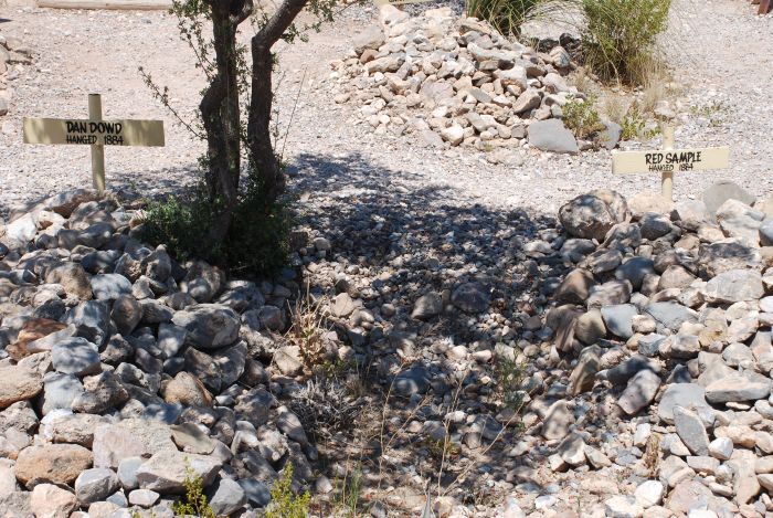
And here is a group that was hung together - legally. That was in March 1884. Maybe the hanging is related to the event mentioned below. |
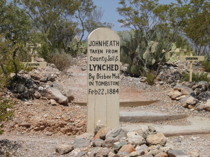 |
John Heath was removed from jail and lynched in February of the same year. Maybe this lynching was the reason for the hangings, two weeks later. |
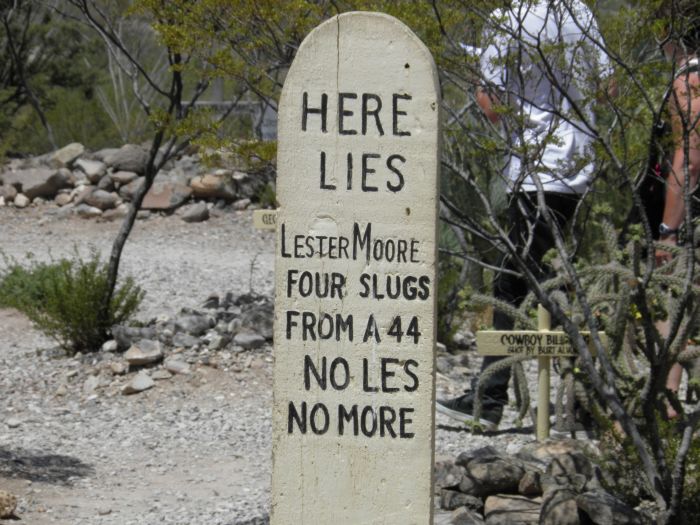 |
Some inscriptions are quite poetic, like this about Lester Moore, who was killed by four slugs from a 44. It is often shown as example of Boot Hill inscriptions. |
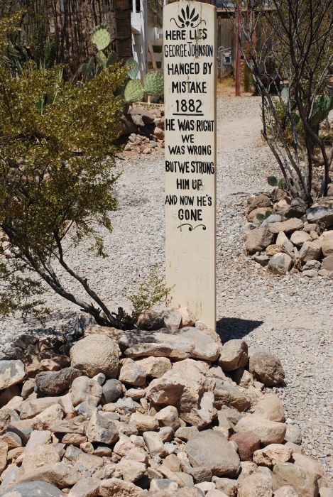 |
I like this more though from the grave of George Johnson, hanged by mistake: "He was right and we was wrong, but we strung him up, and now he's gone." |
 |
Boot Hill Graveyard also has a lot of plants. |
 |
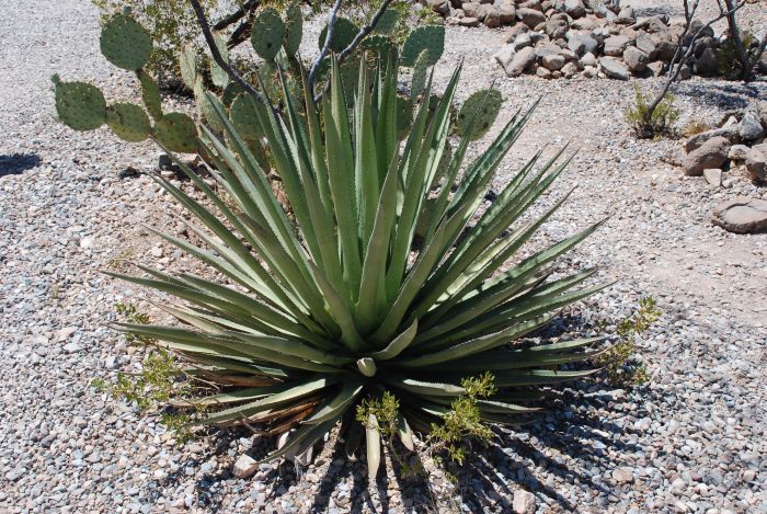
Like this agave. |
 |
And another species of cactus. |
 |
And a blooming cactus too. |
 |
A little closer. |
 |
And very close. To get this picture I got too close to the cactus, and it took me several days to before I had removed all the thorns. |
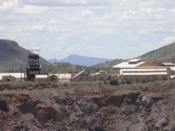 |
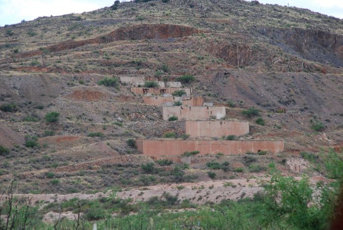
The next town we passed was Bisbee. This is an old copper mine town, and you can still see the one of the mines. |
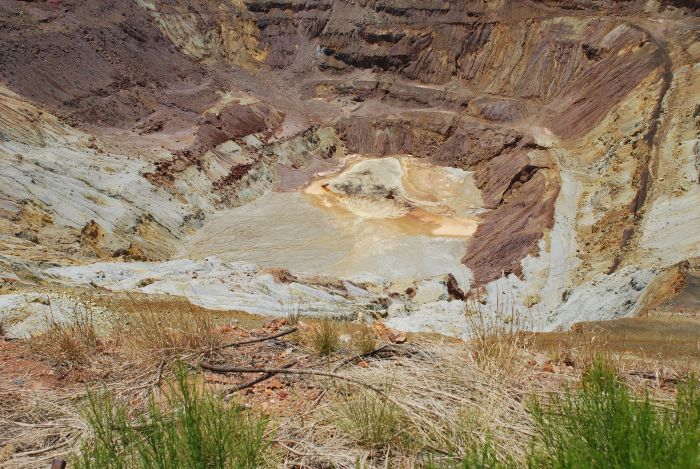 |
The bottom of the mine. |
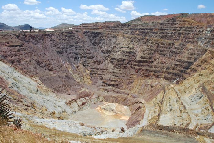 |
And the terraces, where the copper was mined. |
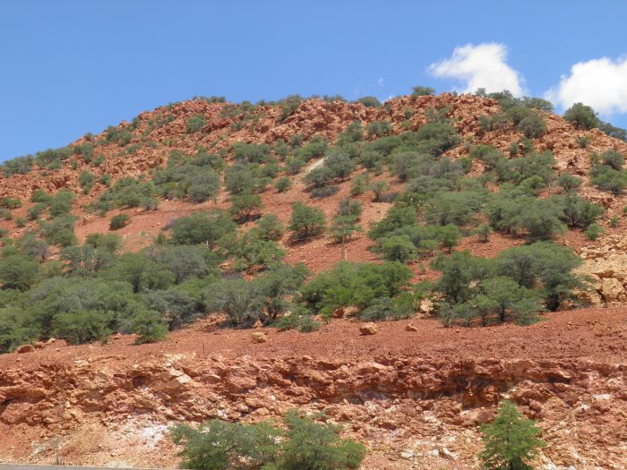 |
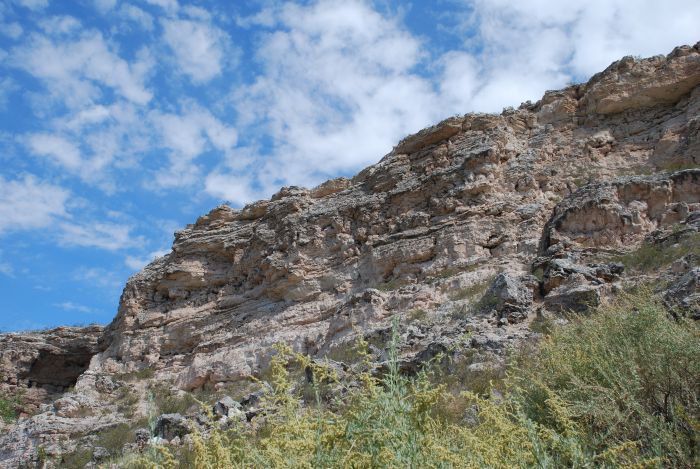
From Bisbee we continued south through interesting landscapes. |
 |
Heading to the Mexican border. |
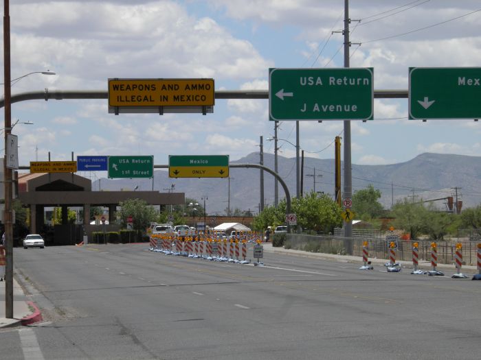 |
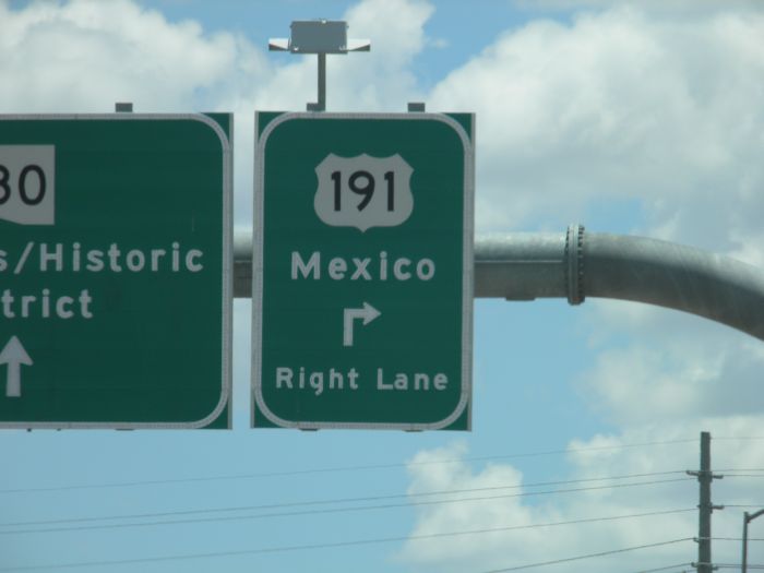
Which we reached in Douglas. We didn't cross the border, but this was the southernmost point of this years vacation. |
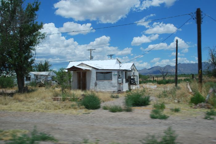 |
The town of Elfrida. Obviously a poorer part of USA. |
 |
In these mountains Apache chief Cochise had his stronghold. |
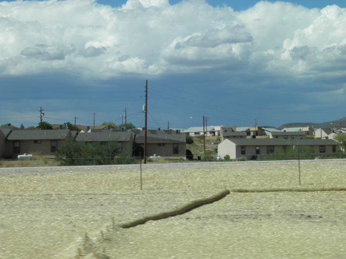 |
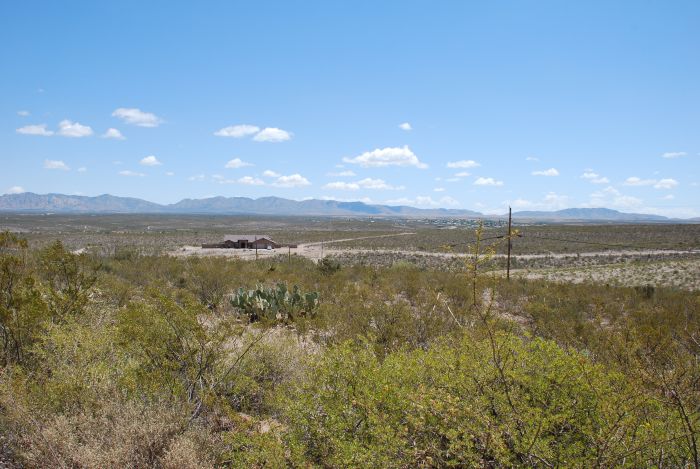
And here we are driving through the San Carlos Apache Indian Reservation; the poorest indian reservation in the United States. |
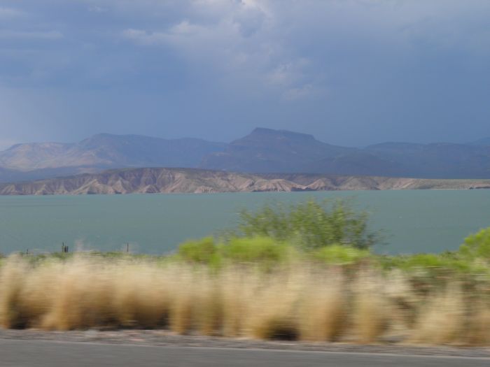 |
Heading towards central Arizona, we passed Roosevelt Lake. |
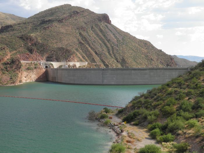 |
The lake was created by damming the Salt River and the Tonto River. |
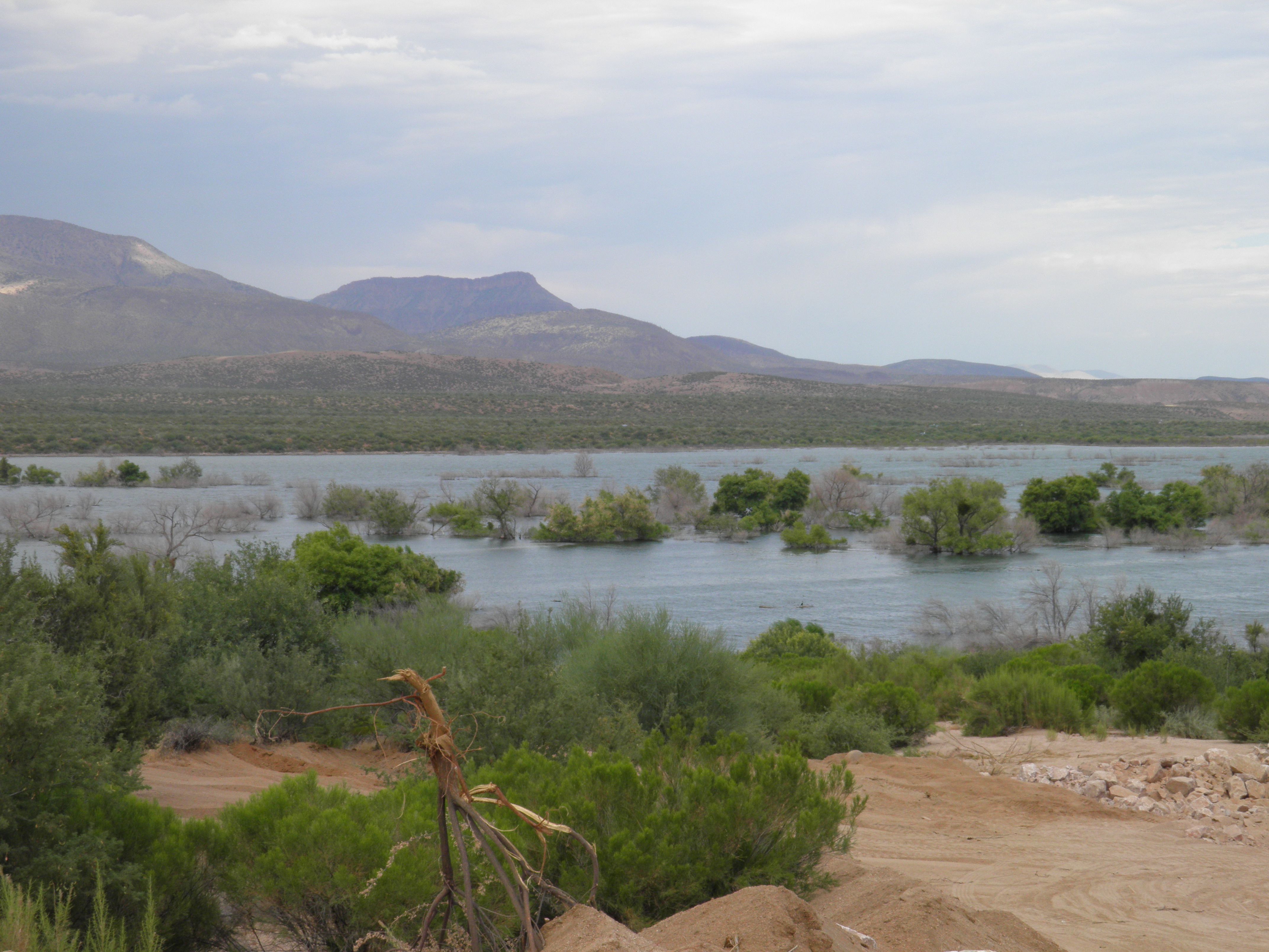 |
In the northen end of the lake, it was very visible, that the water was high. |
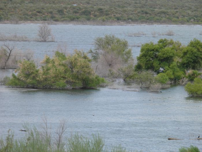 |
A lot of land had been flooded. |
 |
Next day, we drove west on small roads to the town of Camp Verde. |
 |
Stille heading for Camp Verde. |
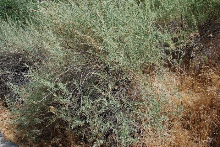 |
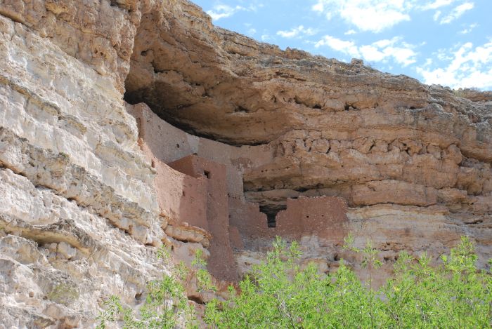
Our goal was Montezuma Castle National Monument, and the first thing we saw was this saltbush. |
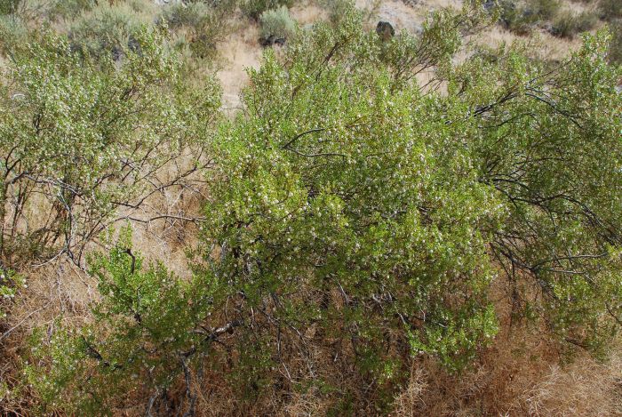 |
And a creosote bush. This is a strongly scented shrub, that in Spanish are called "the little stinker! |
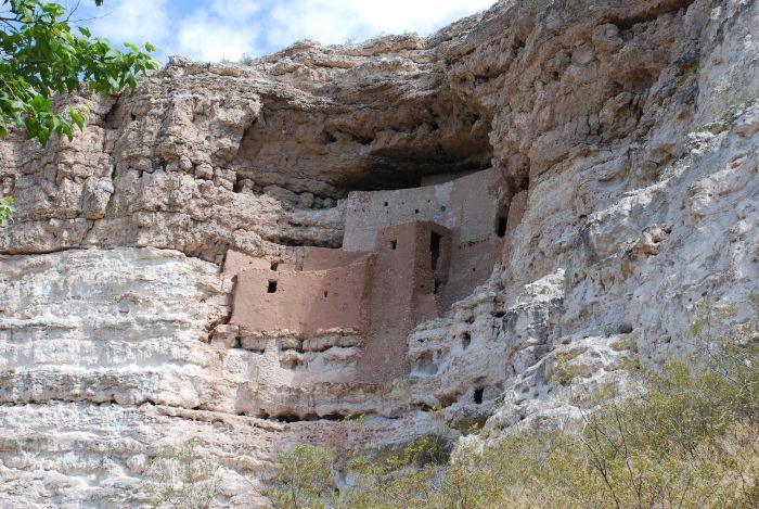 |
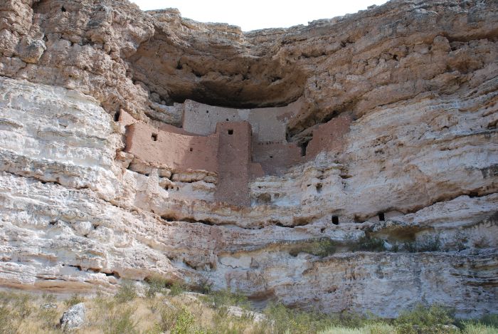
The "castle" itself. Build around 1125 by the Sinagua people and deserted again around 1425. Around 50 people have lived in the building, that have five floors and 20 rooms. |
 |
The first white visitors thought the place was build by the Aztecs and named it for Aztec emperor Montezuma (actually Moctezuma). |
 |
There have also been found remains of a larger building complex, but this has not survived in its entirety. |
 |
The castle from another angle. |
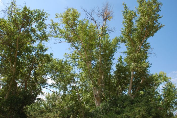 |
The area has a lot of flowers, shrubs and trees. Here a dogwood. |
 |
And this is an acacia. If anybody thinks I suddenly turned into a botanist, they are wrong. Most trees and bushes was marked with signs. |
 |
The castle has not been easy to gain access to. |
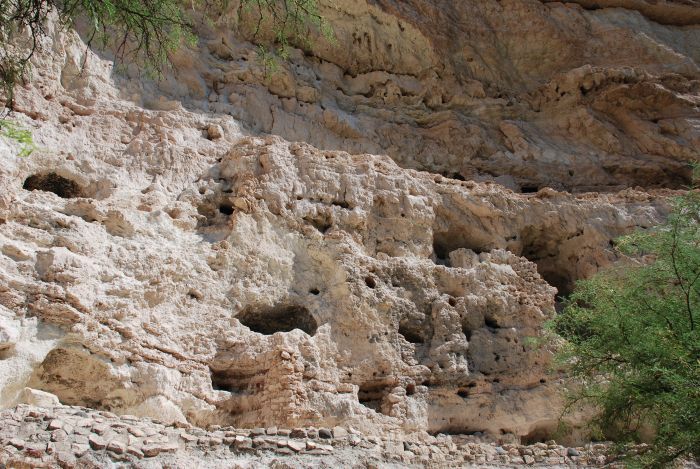 |
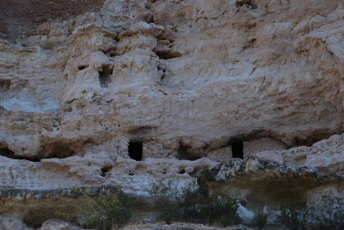
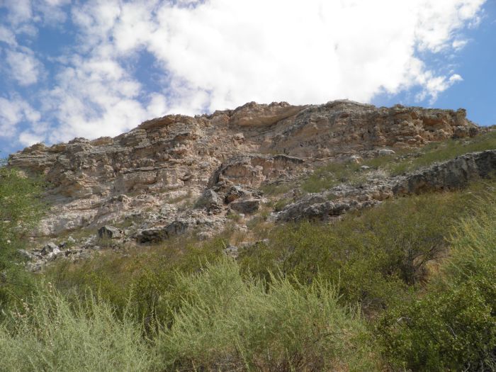
The many caves in the mountain side was used for storing food and other necessities. |
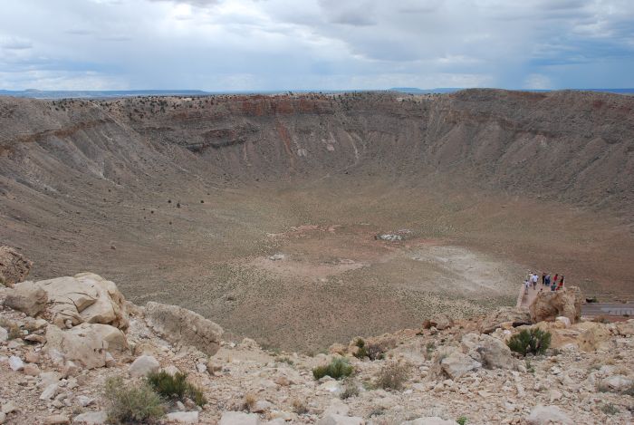 |
Except for a short stop in Flagstaff we continued to Arizona's famous meteor crater. 50.000 years ago the earth was hit by a meteor with a diameter of around 150 feet and a weight of 300,000 ton. The speed at impact was around 30,000 miles per hour. |
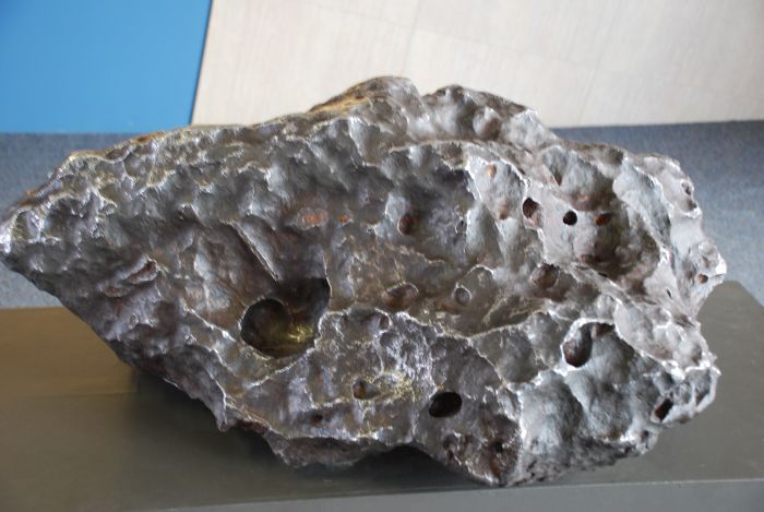 |
The meteor almost vaporized and this is the largest piece found. It meassures around 15 times 12 inches. |
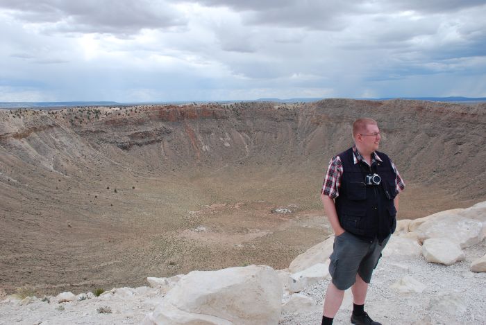 |
Tim at the edge of the crater that has eroded a lot in the last 50,000 years. It is almost 4,000 feet across and 550 feet deep. It is surrounded by a 150 feet high rim. The center of the crater is filled with a layer of gravel, almost 800 feet thick. |
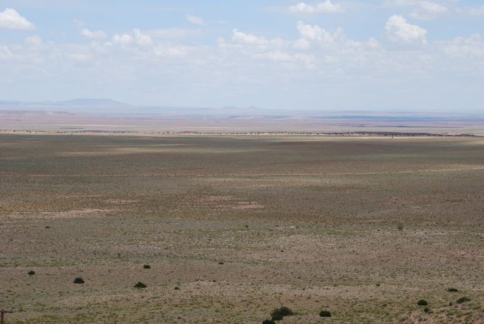 |
The surroundings are flat for miles. |
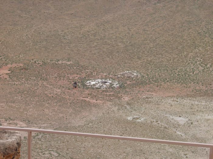 |
In earlier days it was supposed that the complete meteor was buried somewhere below the surface and a lot of digging took place. Remains of the digging equipment is still at the bottom of the crater. |
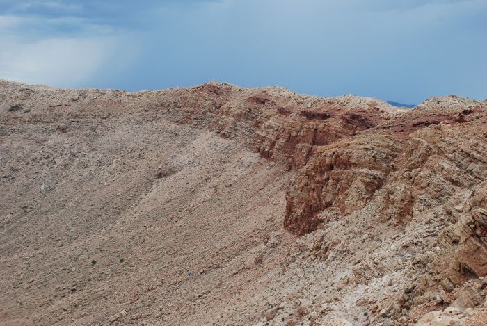 |
Part of the rim. |
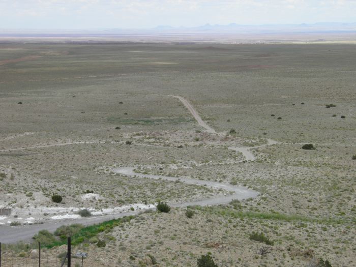 |
And the road across the plain. |
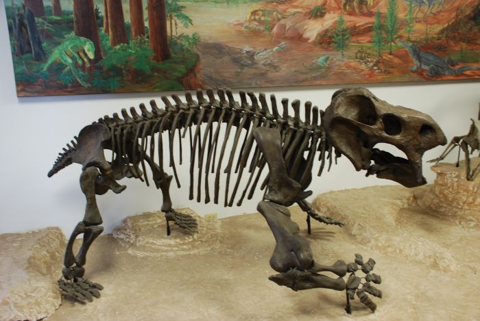 |
At the crater you find a small museum that mostly has exhibitions connected to meteors and other similar phenomenons, but it alså shows some fossils, found in the aera like this Placerius Hesternus, a lizard with mammal-like features, which lived from plant foods. 9 feet in length and weighing 2 tons, you wouldn't want him to step on your toes. |
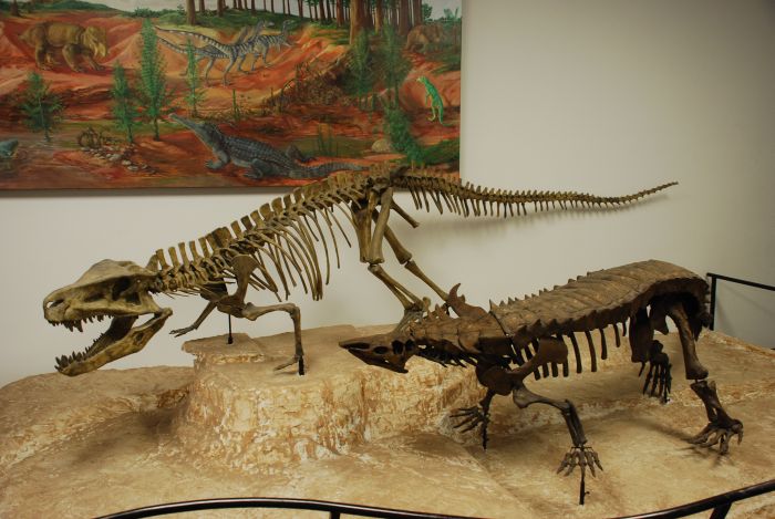 |
The animal at the back is a Postosuchus Kirkpatricki, a relative to modern day crocodiles. Being about 15 vfeet in lenght it walked more upright than a crocodile. The animal in front is a Desmatosuchus Haplocerus, another crocdile relative, but unlike it's present relatives, it was a herbivore. |
 |
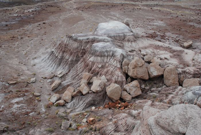
After the visit at the crater, we drove further east, almost to the New Mexican border, for a visit to Petrified Forest National Park. |
 |
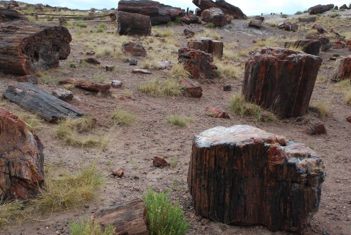
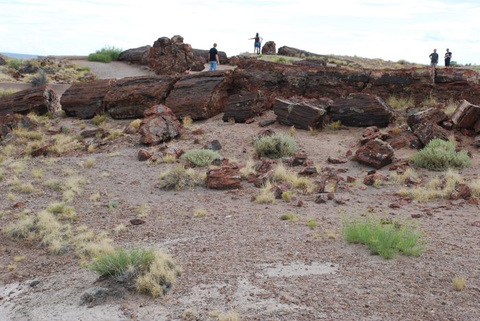
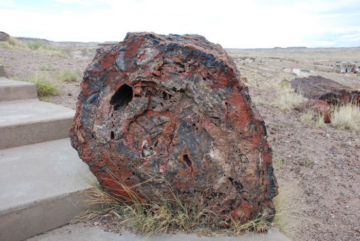
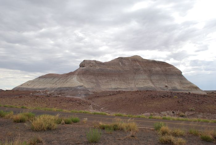
In the southern part of the park, you find the majority of petrified wood, some almost as whole trees others in bits and pieces. |
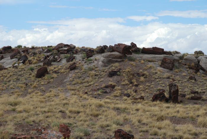 |
These trees didn't grow in the area but was flushed here by rivers and floods around 200 million years ago. |
 |
Later they were buried in volcanic ashes, containing silicats, that entered the wood and turned into the quartz that makes the petrified trees. |
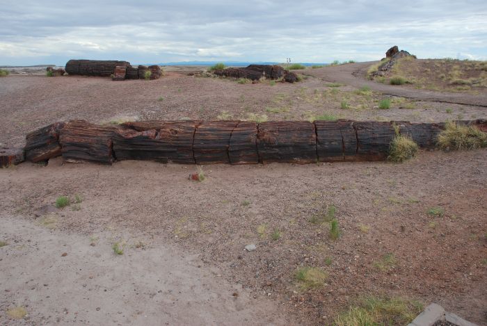 |
The layers that covered the trees eroded, and the trees were left as we see them today. |
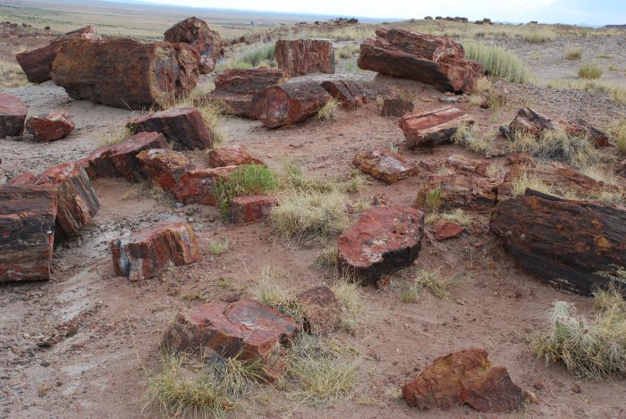 |
The different colors are due to the quartz contaning minerals like iron. |
 |
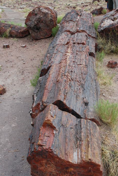
The quarts is really visible here. |
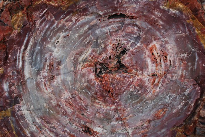 |
And as shown here, even the tree's growth rings are visible in chrystalized wood. |
 |
As seen from the person in the foreground, some of the trees were really big. Most of them belonged to the species Araucarioxylon arizonicum, that could grow to almost 200 feet. Nine species of tress, now all extinct have been found in the park. |
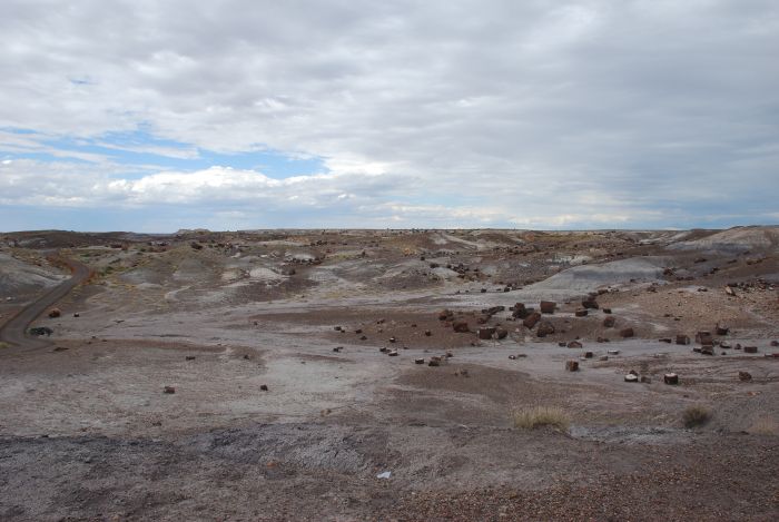 |
The trees are spread over a large area. |
 |
Besides from trees, also rock fomations are found in the National Park. |
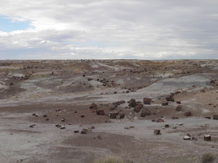 |
But trees are the majority. |
 |
Trees - and rock formations. |
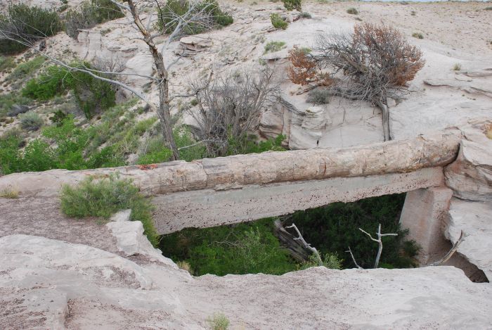 |
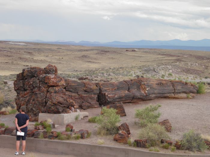
This tree that crosses the ravine is called Agate Bridge. In 1917 the "bridge" was supported by a concrete span. Today no such thing would be done. Nature would take it's course, the tree would be left to disintegrate and finally fall into the ravine. The same thing will of course still happen, as the concrete span is no longer maintained, but it will take a bit longer. |
 |
Another rock formation. |
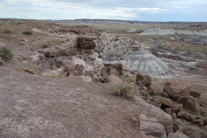 |
Even more rock. |
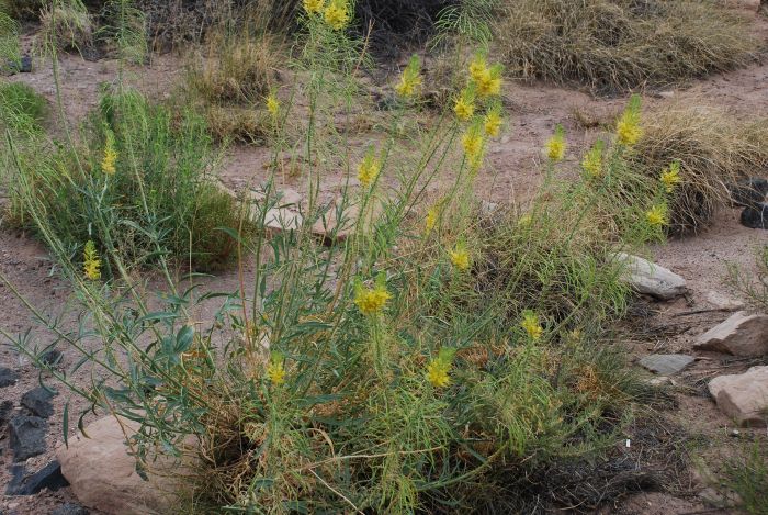 |
Even though the national park is in a desert area on top of the Colorado Plateau, there is a lot of plants here. |
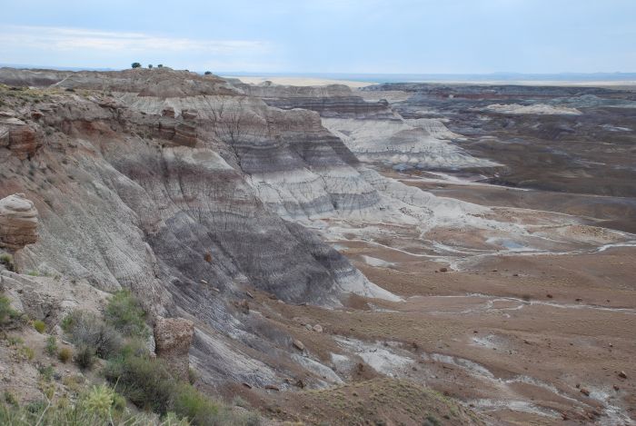 |
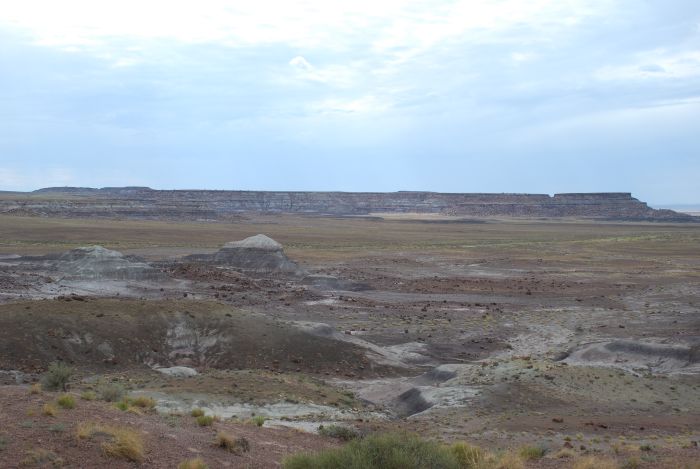
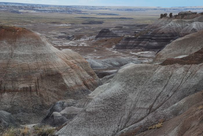
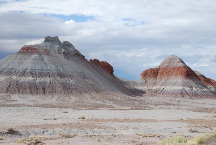
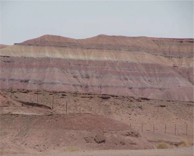
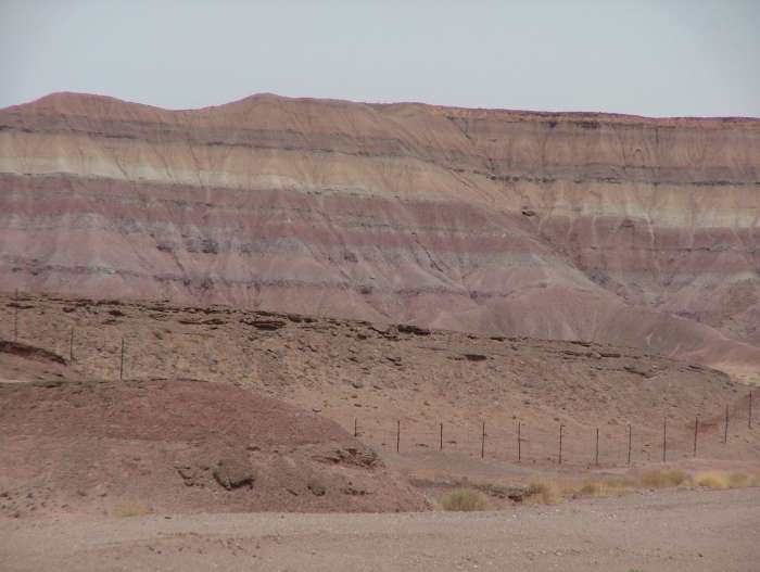
As you get further north the petrified trees get sparse, and the multicolored cliffs become the main attractions. |
 |
Here you see the driedup rivers, that leads the water over the plains, in rainy periods. |
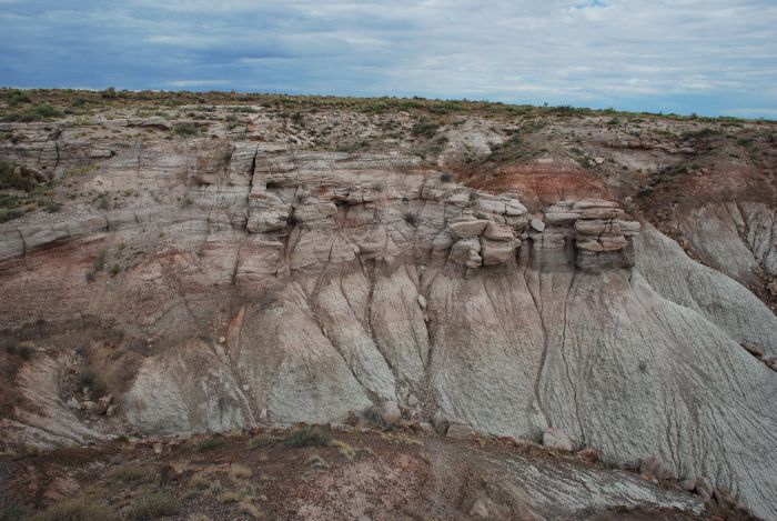 |
And the water has even eroded the rock. |
 |
A riverbed and striped rocks. |
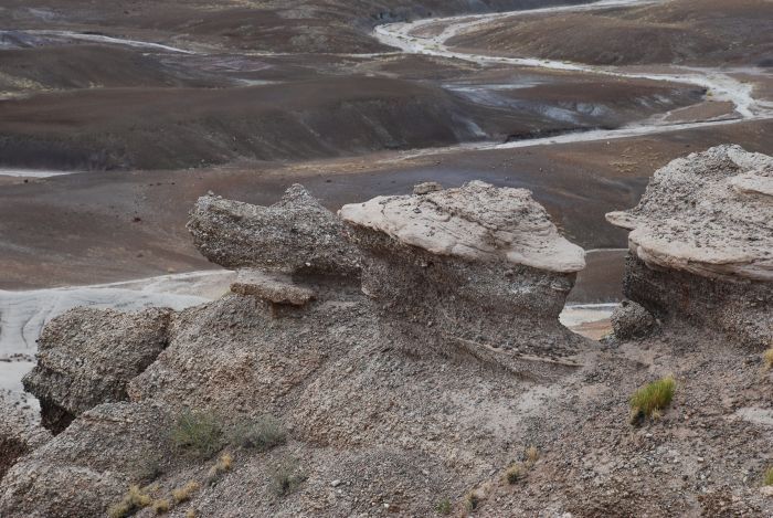 |
A turtle-like rock and another riverbed. |
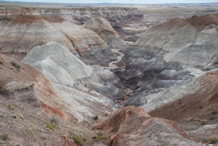 |
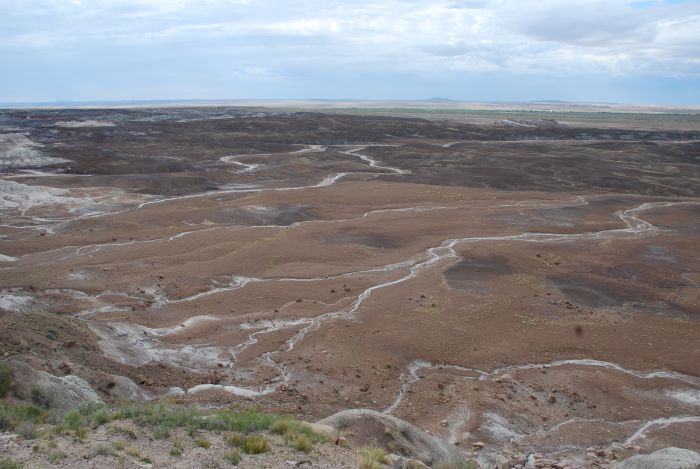
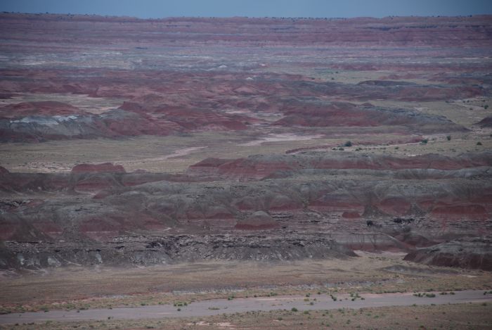
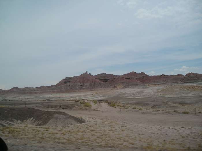
Another riverbed in the Painted Desert in the northern part of the NP. |
 |
Painted Desert beginds around the small town of Cameron at Route 89 and stretches southwest to the border to New Mexico. |
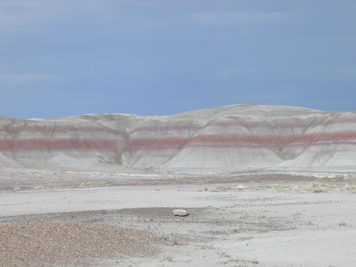 |
More colored rocks. |
|
|
And even more. |
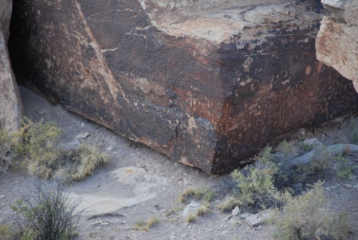 |
The park also contains many traces of former human habitation. The photo shows the so-called Newspaper Rock with many petroglyphs. |
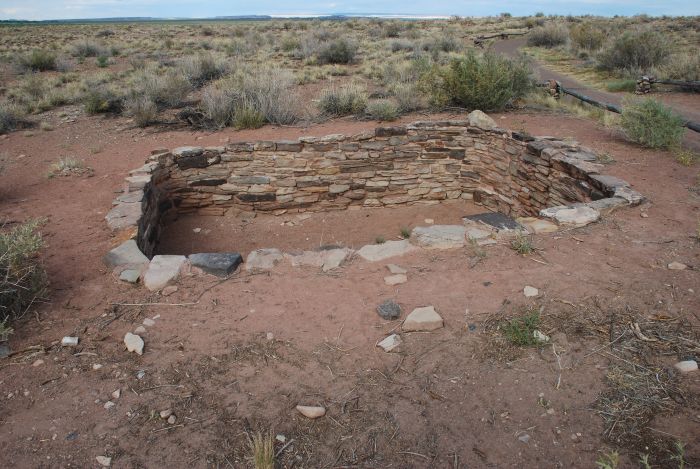 |
And one of the old ruins. |
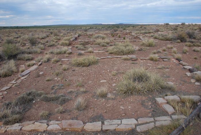 |
The ruins of a larger settlement. |
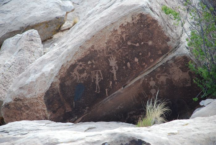 |
And more petroglyphs near the ruins. |
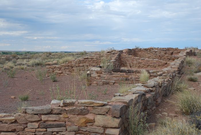 |
Actually there are more than 600 archeological sites within the park. The oldest traces of human activites goes back 8.000 years, but most ruins are from the "ancestral puebloes" period from 900 to 1250 AD. |
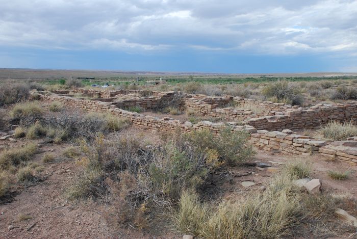 |
The Puerca Pueblo, with around 100 rooms are centered around and open square. There were no doors and windows in the houses. To enter you used a ladder to climb to the roof and through a hole, down to the living quarters. |
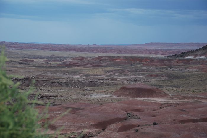 |
It is now getting darker, and when the lights changes, so does the colors of the Painted Desert. |
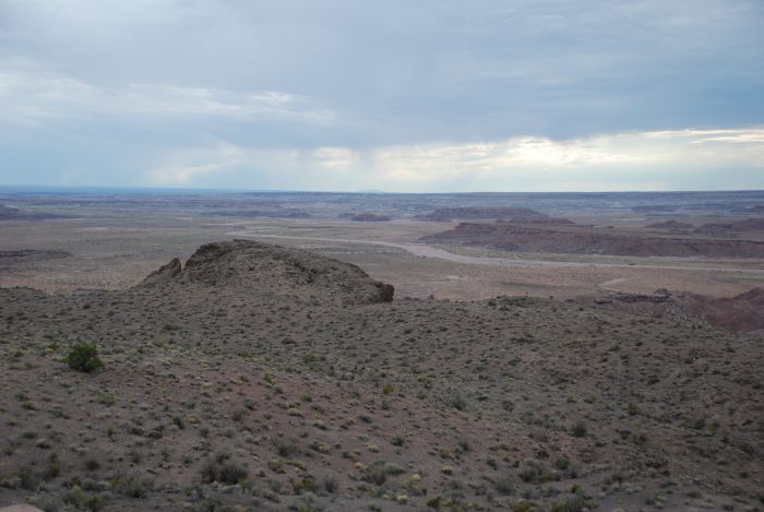 |
Another picture of a park landscape. |
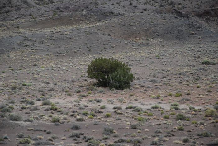 |
And a lonesone bush in the middle of the desert. |
 |
A final glimpse of the multicolored desert. |
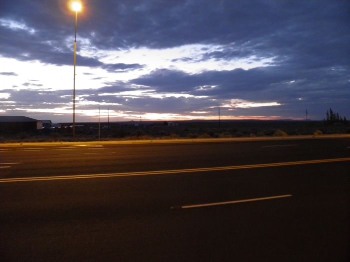 |
And the sun set over the desert. |
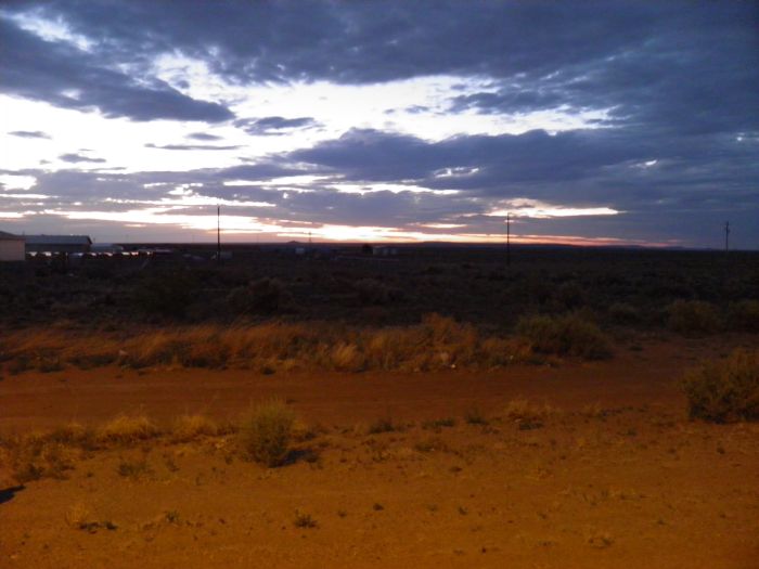 |
As seen from our hotel in Holbrook. |
 |
The next day we visited Sunset Crater National Monument north of Flagstaff. The volvano has it's name from the red colors on the top of the cone, that looks even more red at sunset. |
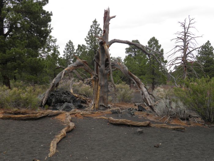 |
Around the crater you find a lot to look at, like this dead tree. |
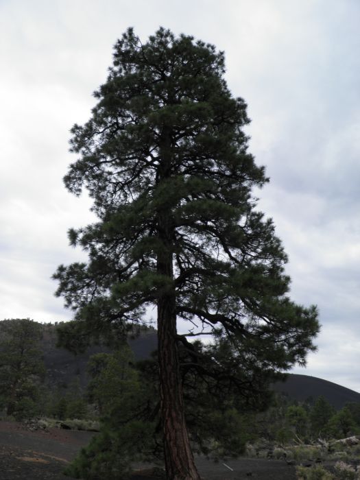 |
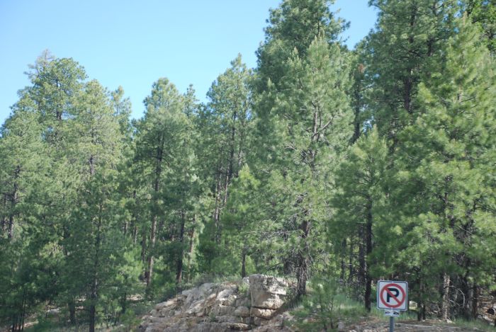
Or this Ponderosa pine. |
 |
And also a number of other bushes are growing in the Volcanic sand. |
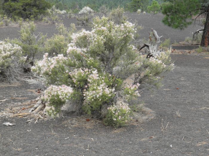 |
Like this Apache Plume, the most common bush in the area. |
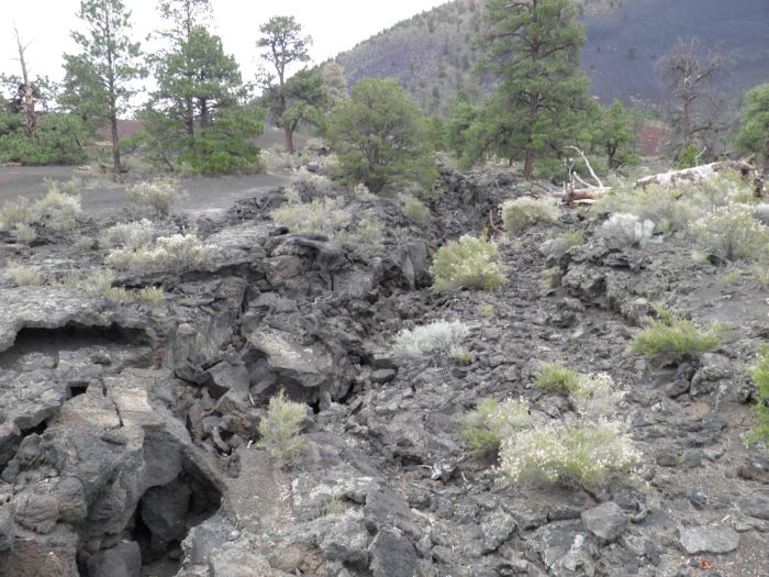 |
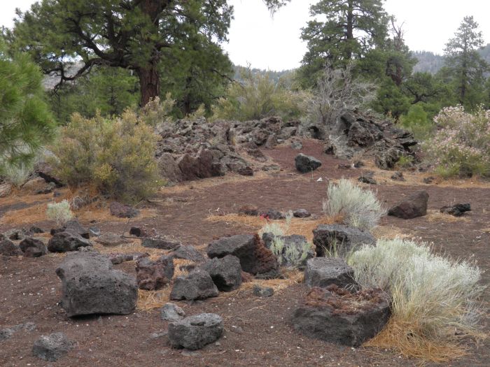
Also a lot of traces of the volcanic activity like this lava flow. |
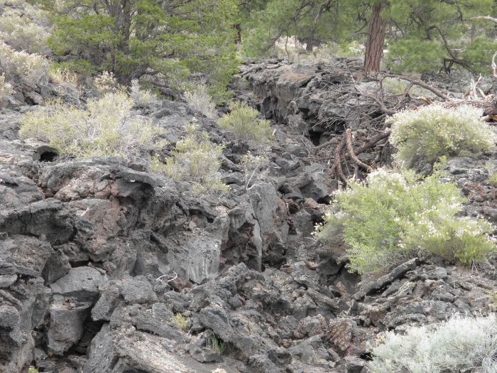 |
And more here. |
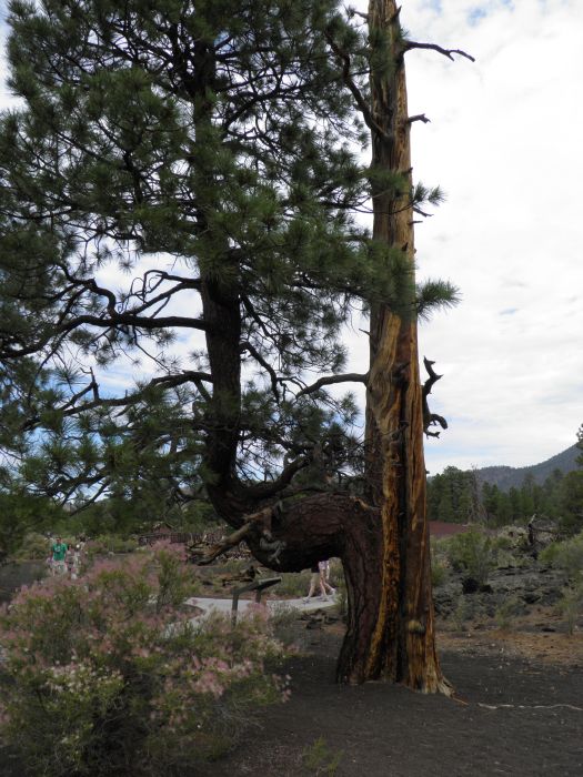 |
Some trees have grown into intersting shapes. |
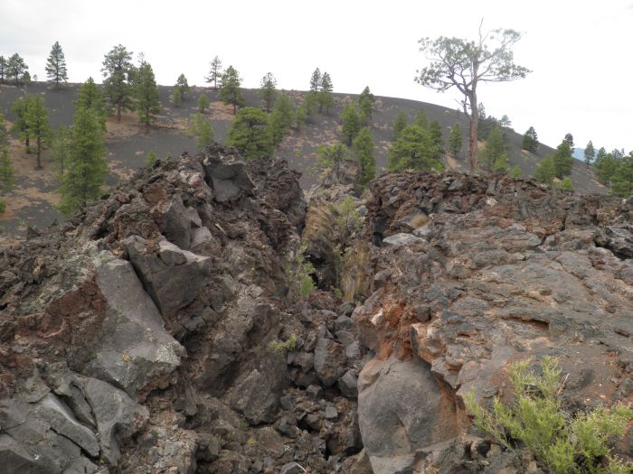 |
Another crack in the lava. |
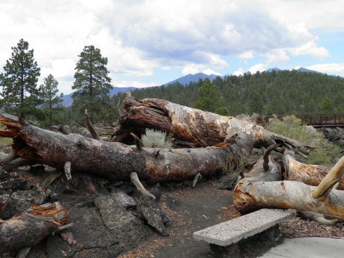 |
And a couple of fallen trees. |
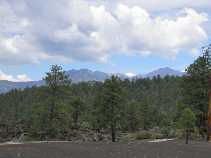 |
View over San Francisco Peaks, the remains of an exstinct volcano. |
 |
A little further west on the I-40, we visited Williams. |
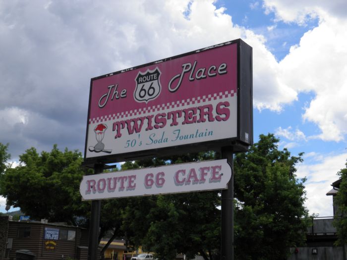 |
Here we visited The Twister Cafe, still kept in the style of the fifties. |
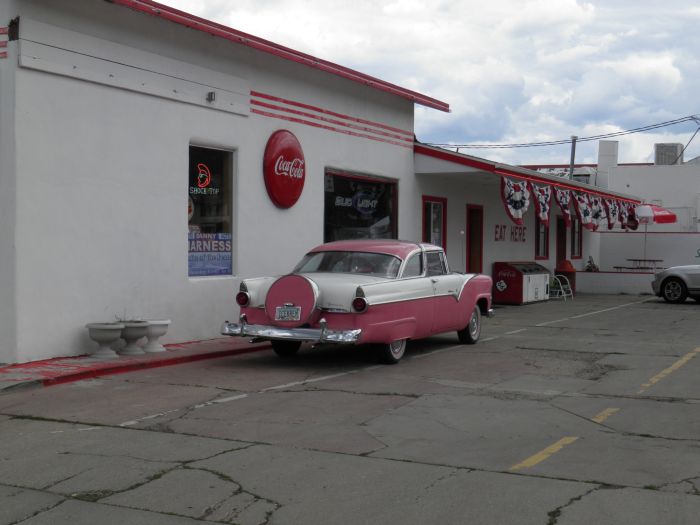 |
Outside the cafe, you can look at this pink and white wonder. |
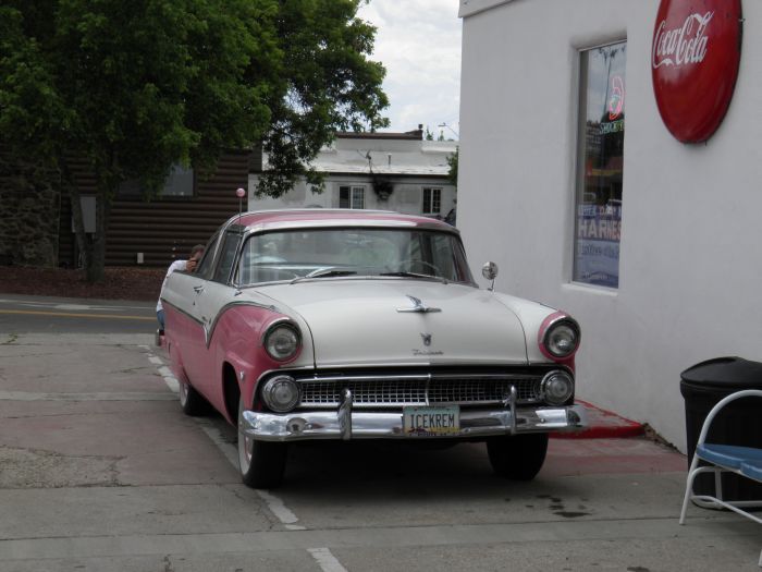 |
Some tourist guides tells about the pink Cadillac, but the car is actually a Ford Fairlane Crown Victoria from 1955 or 1956. |
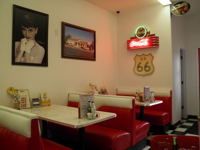 |
The foot was good and the interior was kept in style. |
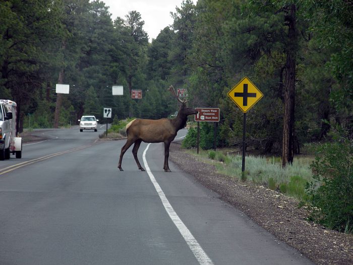 |
We have just entered Grand Canyon National Park, and were met by this elk, playing road block. |
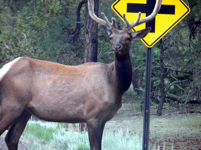 |
Elks are not as big a moose, but still big enough to cause a lot of damage if you hit them with your car. |
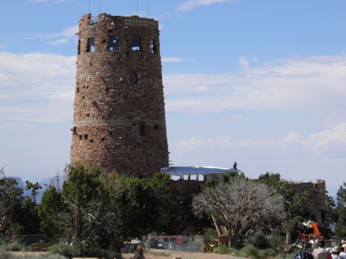 |
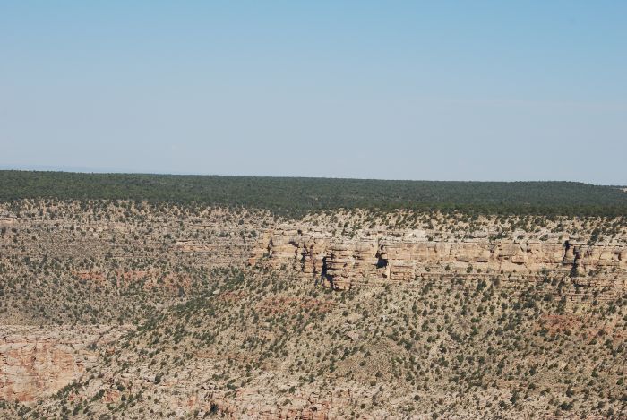
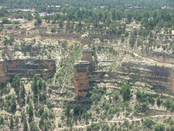
Tower at Desert View viewpoint near the east entrance to the NP. |
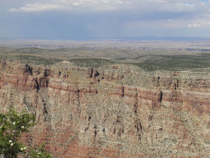 |
From Desert View you have a great view of the canyon as well as the desert. |
 |
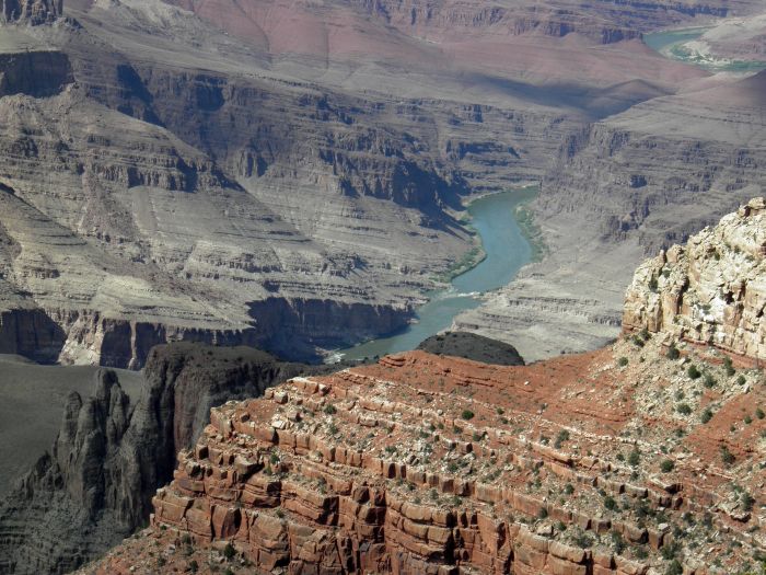
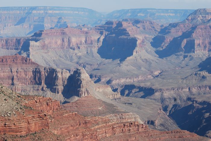
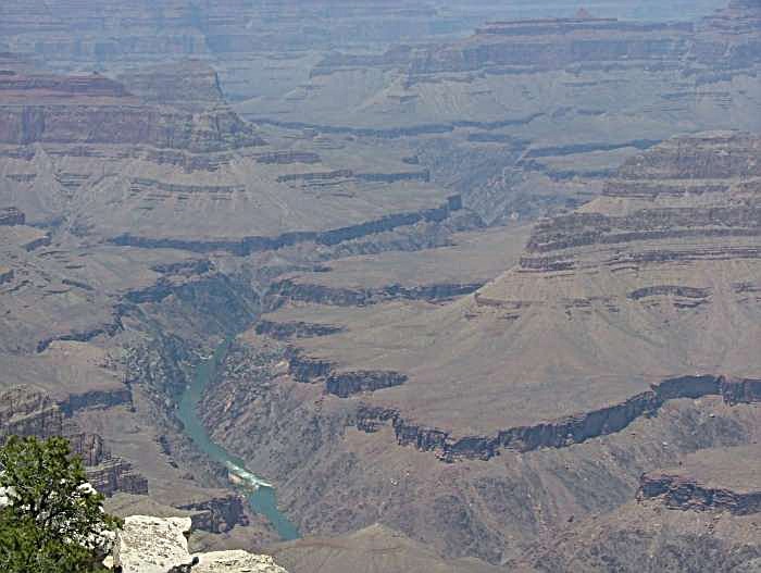
When we got there, there was a lot of haze but in spite of that you get a good impression of the Colorado River winding throug the canyon. |
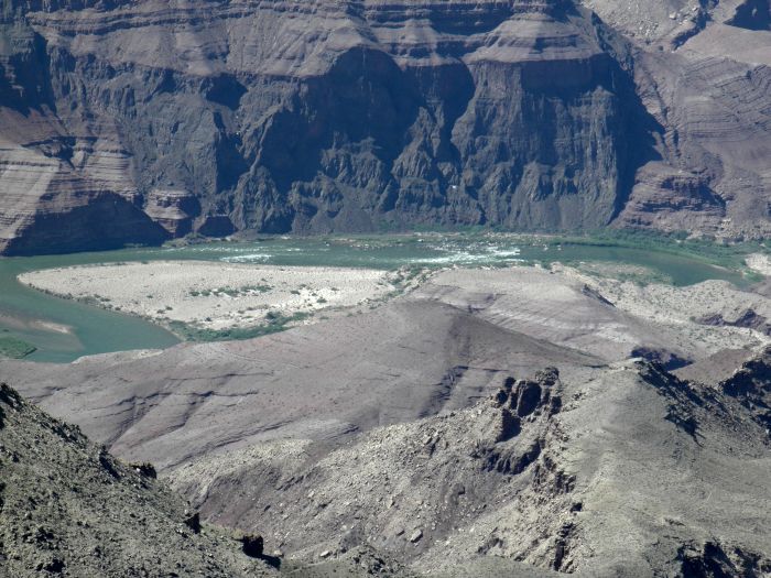 |
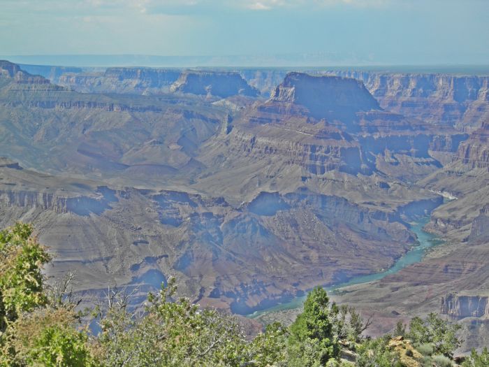
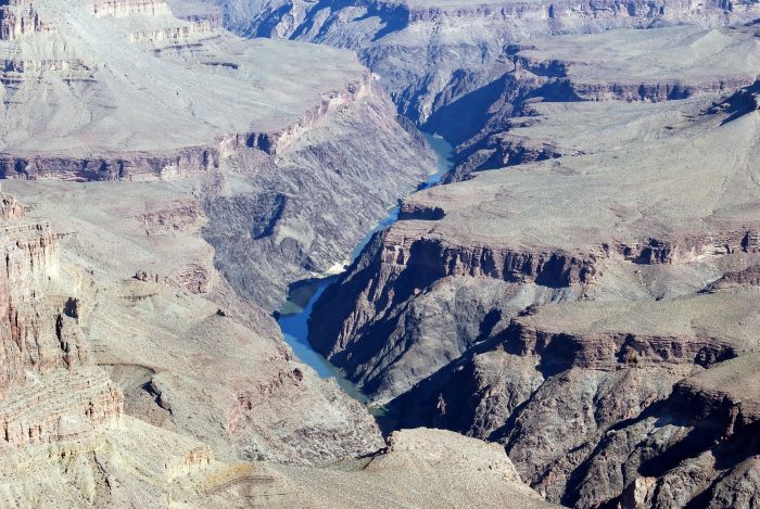
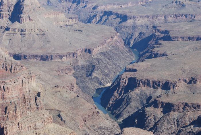
Another overlook is at Lipan Point with an even better view of the river. |
 |
At Lipan Point the canyon reaches it's largest depth. |
 |
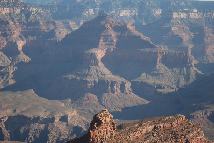
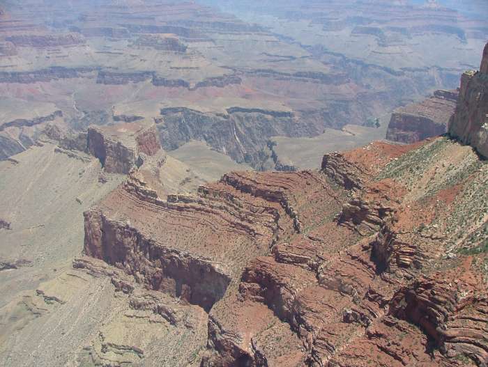
At Moran Point overlook you can enjoy some of the many interesting rock formations, that has been created by the erosion. |
 |
Even more rock formations. |
 |
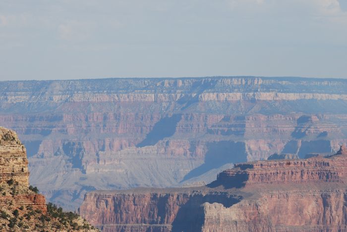
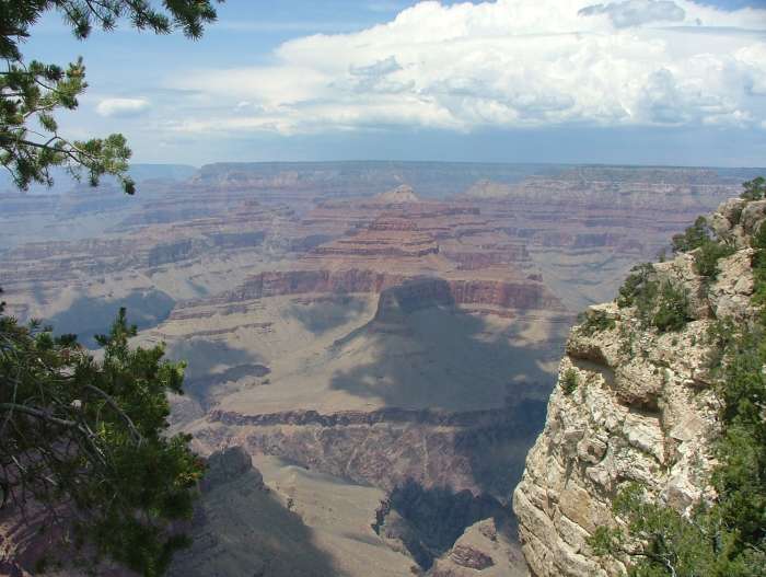
At Grand View Point, there is a fantastic view of the canyon. |
 |
We got our room at Katchina Lodge and enjoyed the view from our window. |
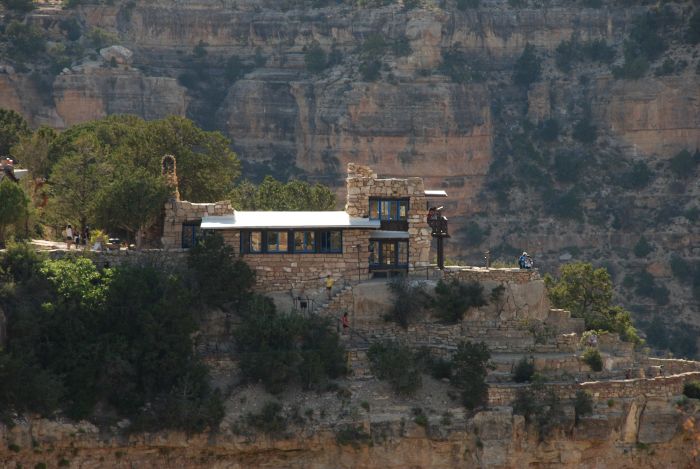 |
And when we looked in the opposite direction, we could see the old photographic studio, Lookout Studio, now used for exhibitions. |
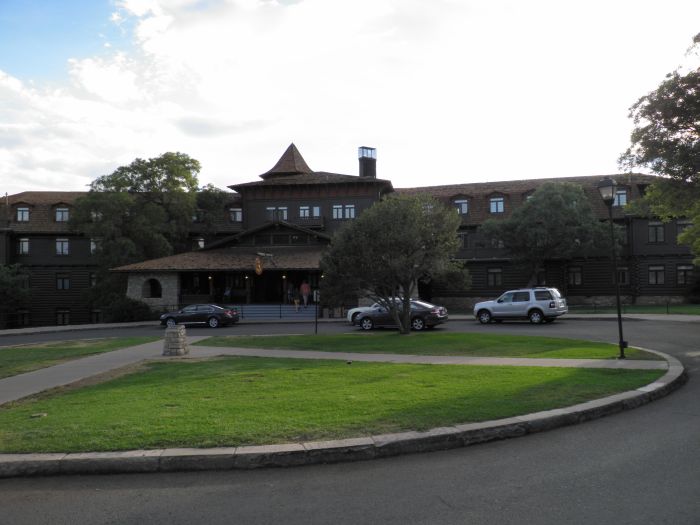 |
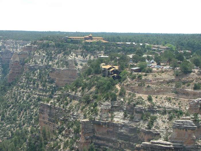
El Tovar Hotel from 1905 was the first hotel built in Grand Canyon Village. |
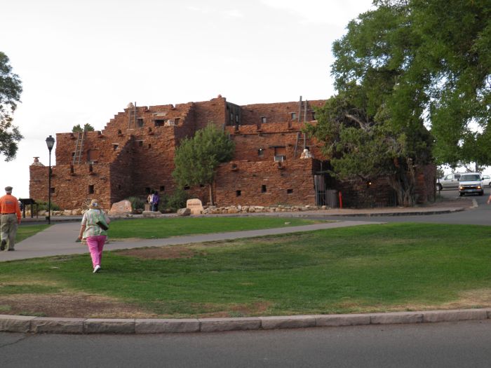 |
Opposite El Tovar is Hopi House, also from 1905 but built in old Hopi style. |
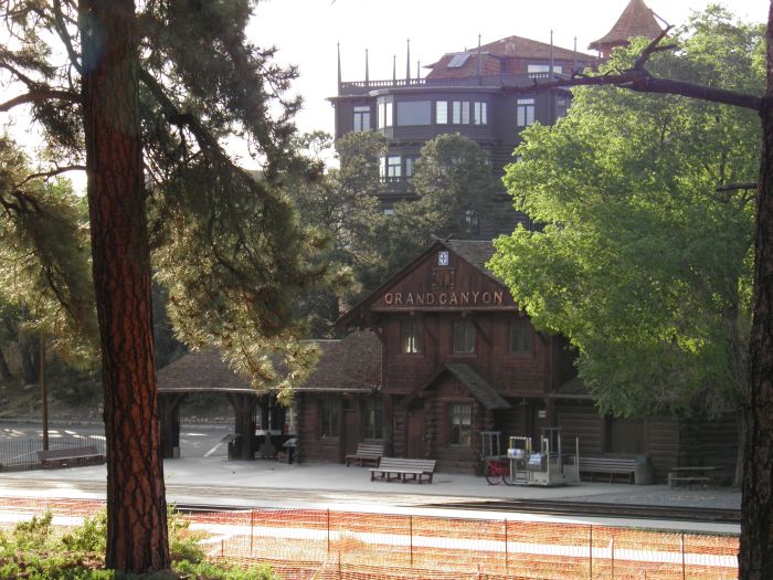 |
And the northern terminus of the Grand Canyon Railway. |
 |
In the late afternoon we returned to the room. |
 |
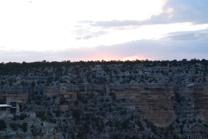
Even later and the sun began to set. |
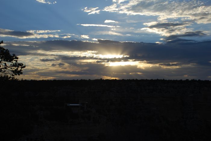 |
Unfortunately sunset was almost hidden behind the clouds. |
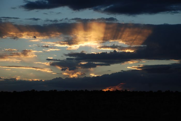 |
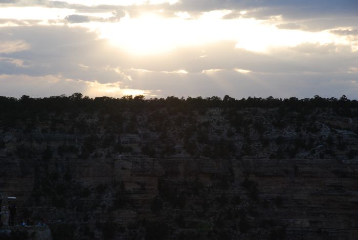
But the clouds created this gloomy look. I almost expect to see the four riders of the apocalypse coming out of the sky. |
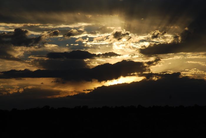 |
And then the sun set. |
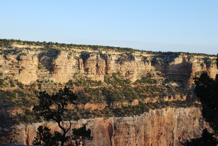 |
The next day we got up early, so no haze had appeared yet. This was around 6AM. |
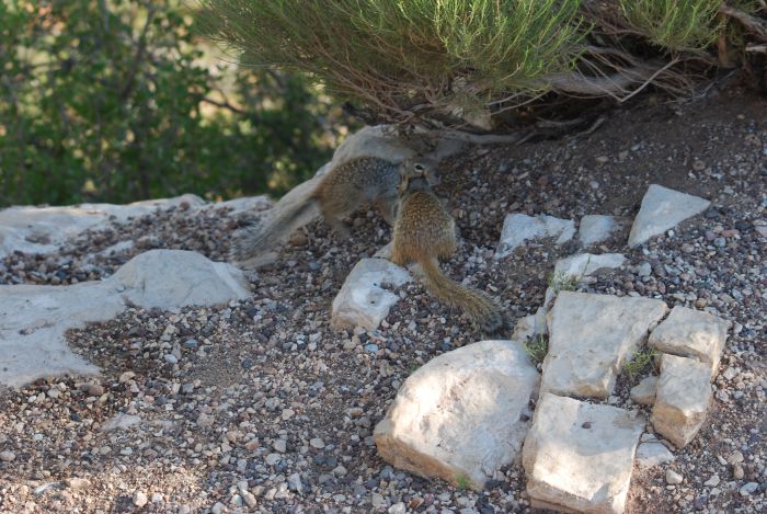 |
A couple of rock squirrels. |
 |
At Hermit's Point at the western end of South Rim road. At 8 AM the haze had already appeared. |
 |
But we could still enjoy the view |
 |
Notice the layers of rock in the background. |
 |
Also from this spot, you have a good look to the almost flat plain on the opposite side of the canyon. |
 |
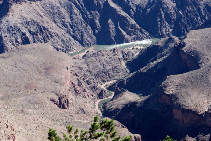
And a view of the river. |
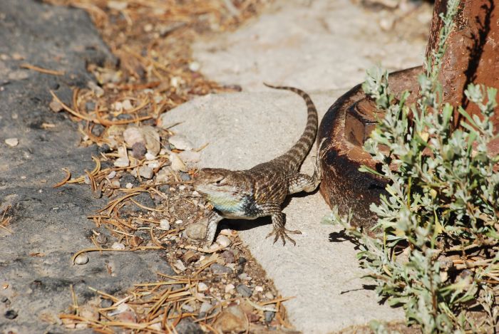 |
At Hermit's Point we met this colorful representative of the animal life in the canyon area. |
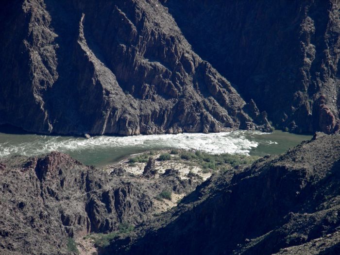 |
One of the rapids of the Colorado River. |
 |
More river. |
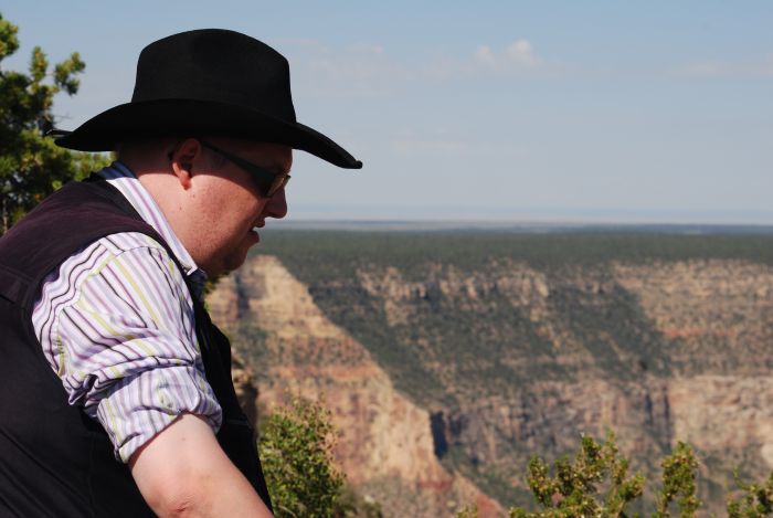 |
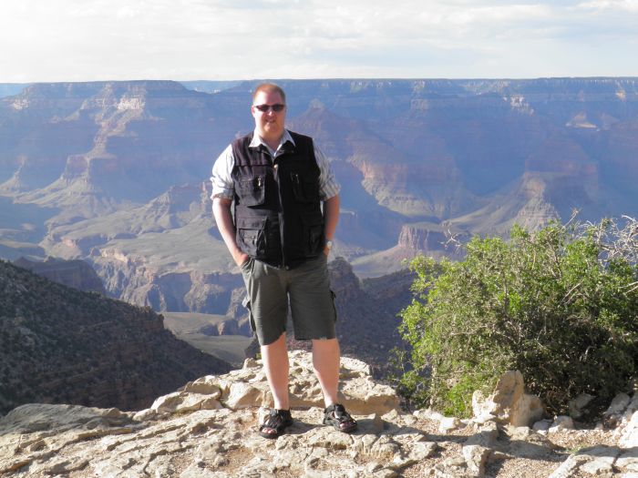
Tim enjoys the view from Powell Point. |
 |
A dried-up riverbed in a side canyon. |
 |
From Powell Point we walked back to Grand Canyon Village and on our way we passed these small cacti. |
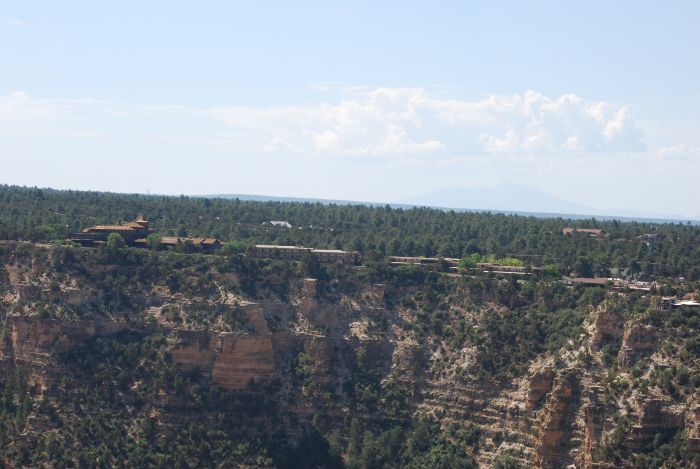 |
View of the hotels in Grand Canyon Village. |
 |
Walking along Grand Canyon brings you close to the edge, so you got to take care of yourself. It's only one step down - but a big one. |
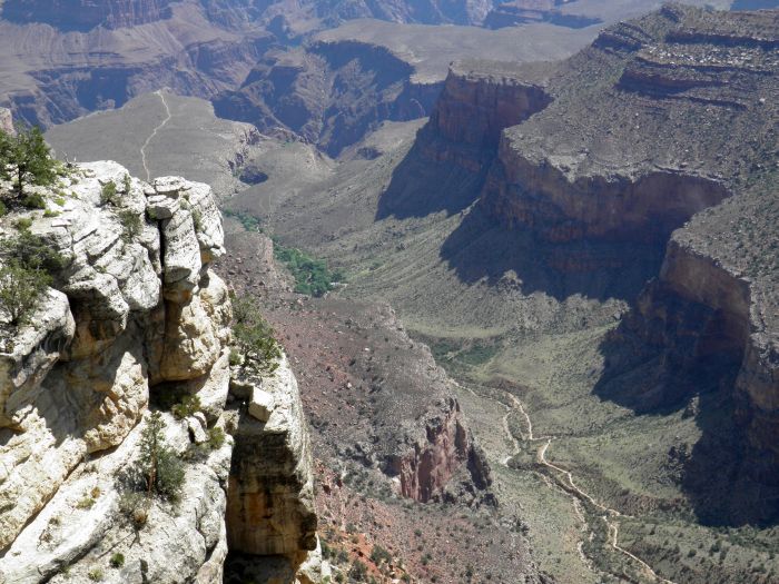 |
Bright Angel Trail - one of the trails. leading to the bottom of the canyon. |
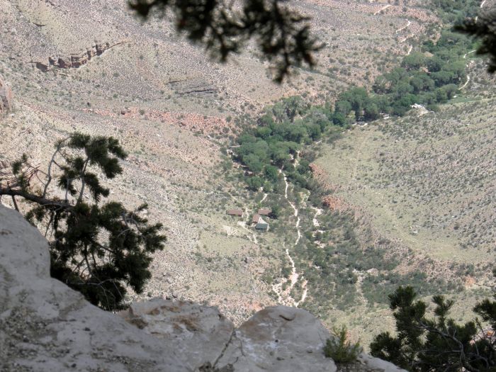 |
Indian Garden, is halfway down the trail. Here you can replenish your water holdings. |
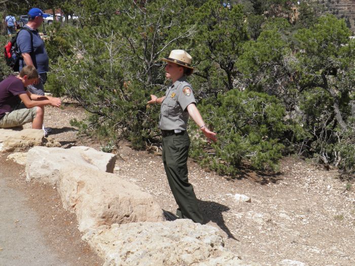 |
Finaslly a picture of Ranger Maggie, busy explaining something about the canyon. |
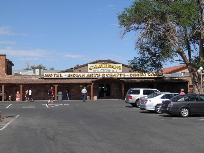 |
The trading post in Cameron on the edge of the Navajo Nation. |
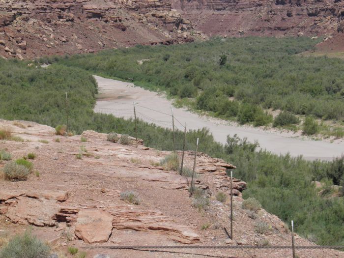 |
Little Colorado River was completely dried up, when we passed it. |
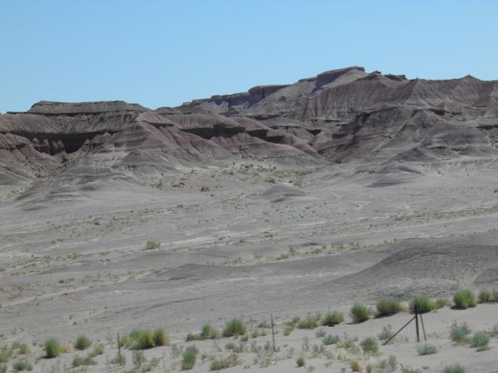 |
Entering the northwestern part of Painted Desert. |
 |
Heading east through Navajo Nation. The moutains ahead is part of Black Mesa. |
 |
And yet another picture from northeastern Arizona. |
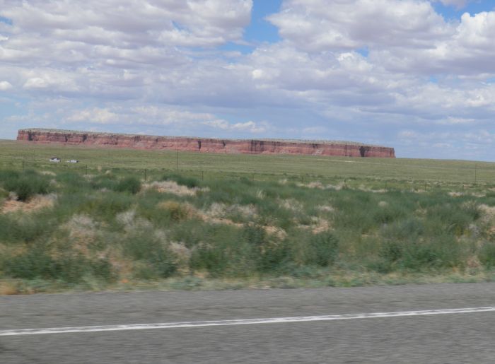 |
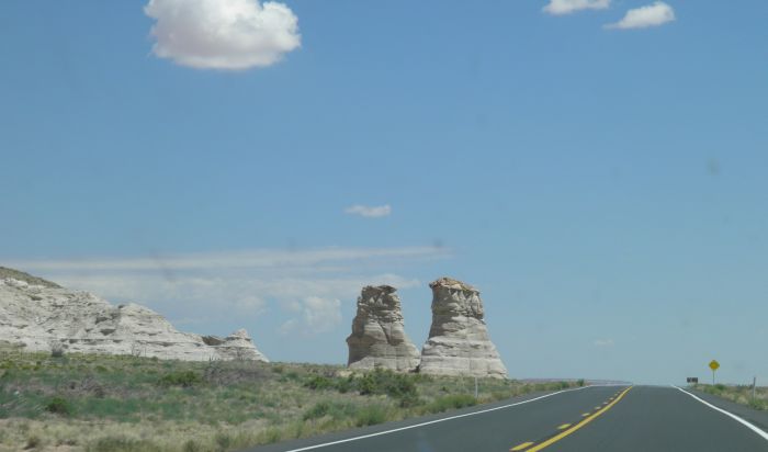
This is the Red Mesa. |
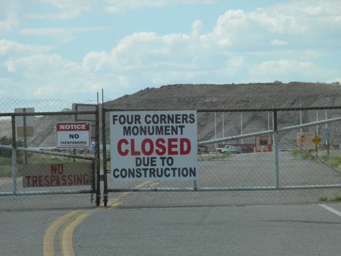 |
We wanted to visit Four Corners Monument like in 2006, but unfortunately the monument was closed. |
|
Pictures from 2006 |
|
 |
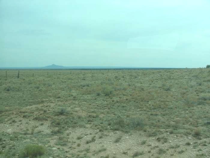
When driving south from Hoover Dam, you find yourself in the southern Mojave Desert, which also extends into the states of Nevada and California. |
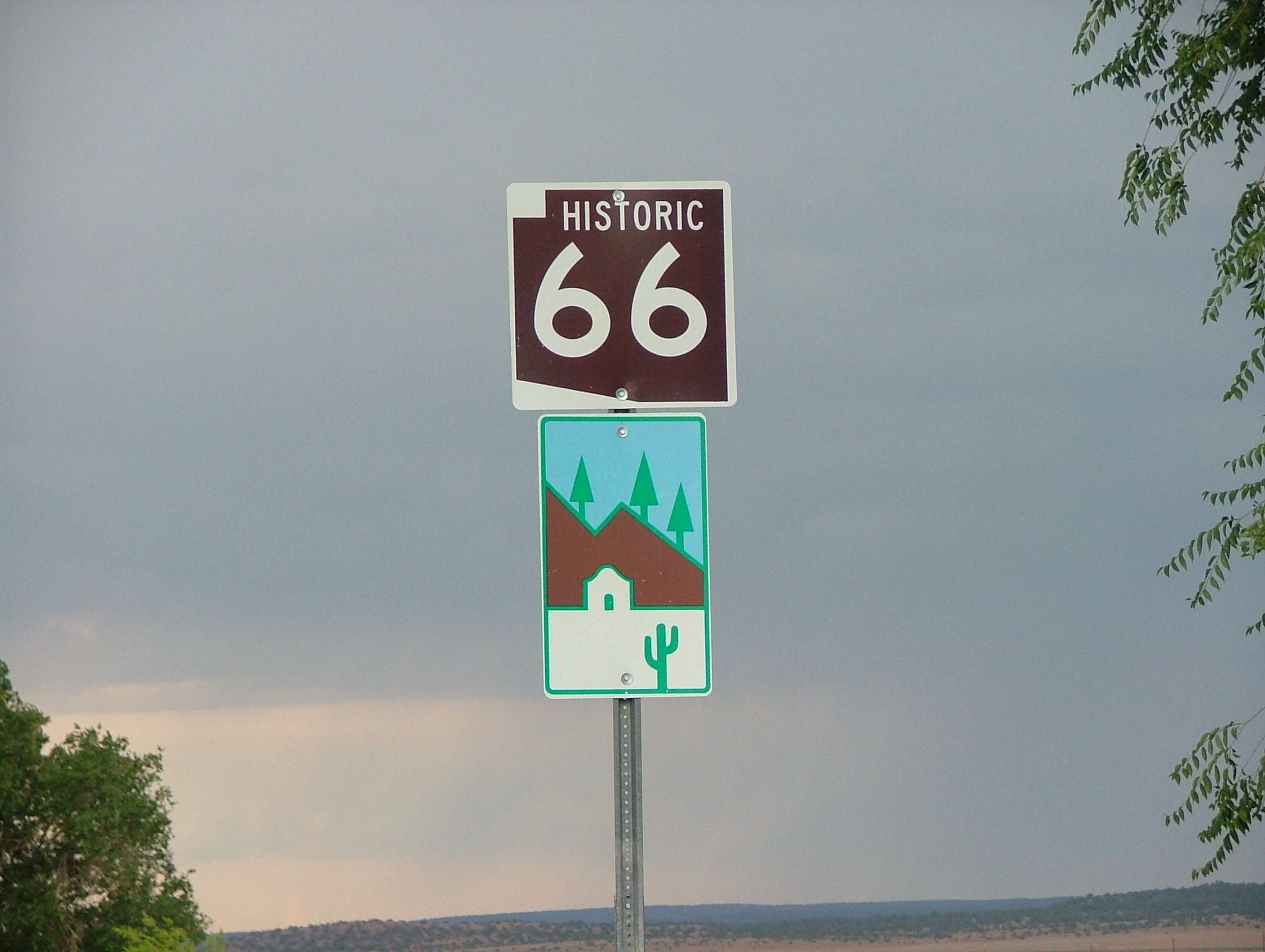 |
At Kingman you can change to I-40, but you can also choose to drive a stretch of Route 66, The Mother Road, Mainstreet of America, or whatever you like to call this cult road. The stretch between Kingman and Seligman is one of the best preserved pieces of the old road. |
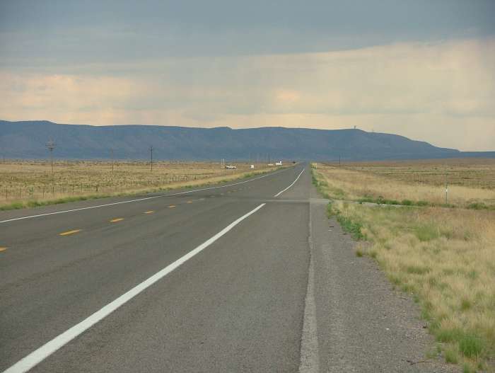 |
The actual road really looks like many other roads in the American southwest, but nevertheless it is an experience to travel on a path that is known from both music and literature, such as in Jonh Steinbeck's The Grapes of Wrath. |
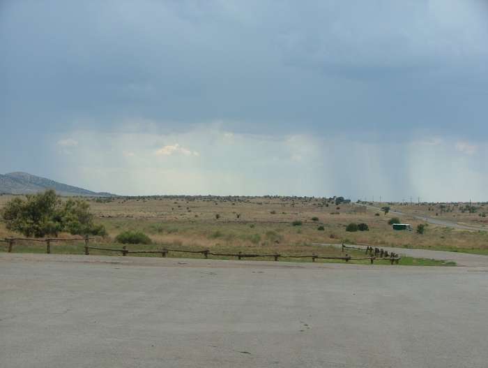 |
The road goes partly through the Hualapai Reservation. When we got there the clouds began to pull together and it was raining in the distance, but we never got more than a few drops ourself. Actually, we didn't even have to use the wipers. |
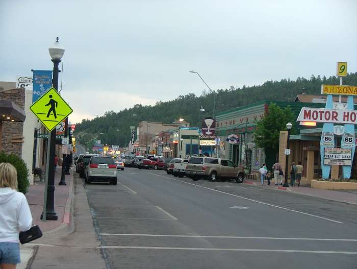 |
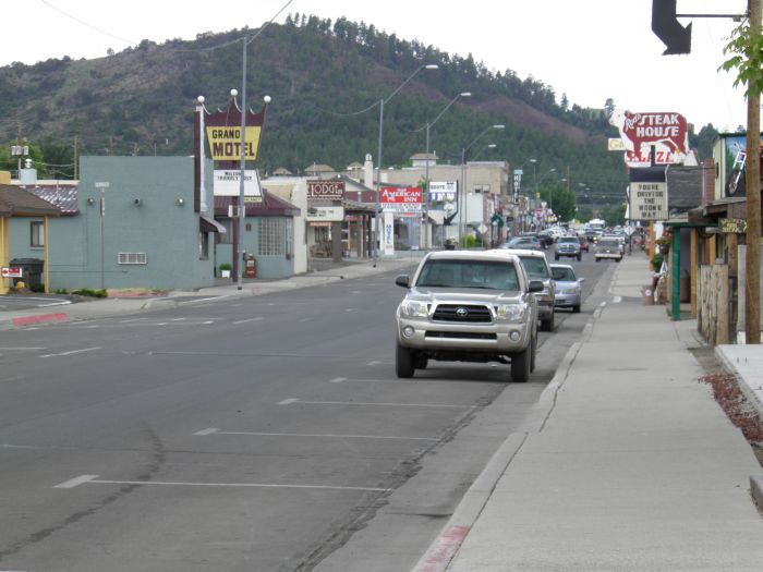
We stayed in the town of Williams, where Route 66 is still Main Street, something you are not allowed to forget for even a minute. |
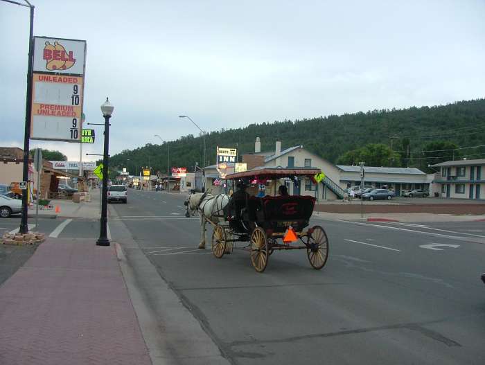 |
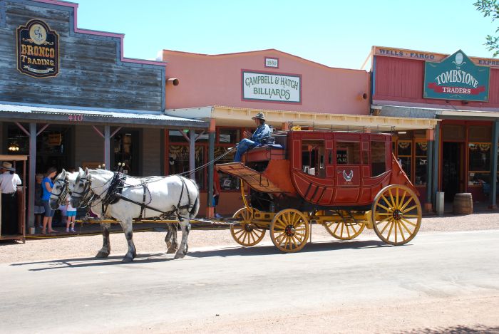
Although the city advertises that there are 30 miles to the nearest traffic light, the vehicle here is not the preferred means of transportation in town. But tourist can buy themselves a stage coach ride. |
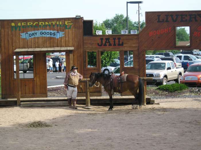 |
From Williams, we took the Grand Canyon Railway to Grand Canyon Village, and before the train left, we attended a "shoot out" in a western set up at the end of the platform. |
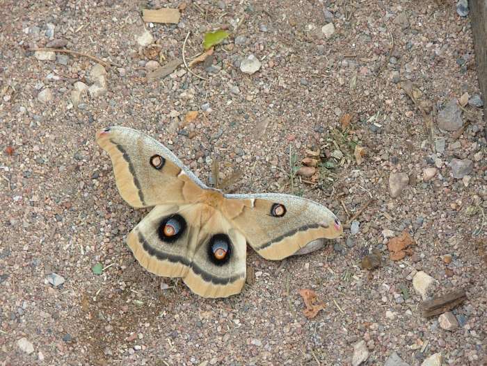 |
It was on that occasion that I got the opportunity to photograph this impressive butterfly, which had a 4" wingspan. Oculea Silk Moth is the name and it may actually have a wingspan of up to 6". |
 |
En route to the Grand Canyon the train goes through varied landscapes. Here we are crossing the prairie, not far from Williams. |
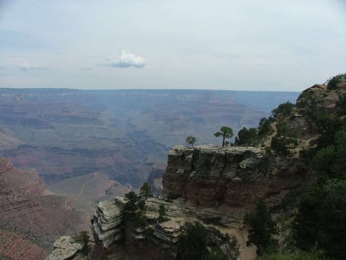 |
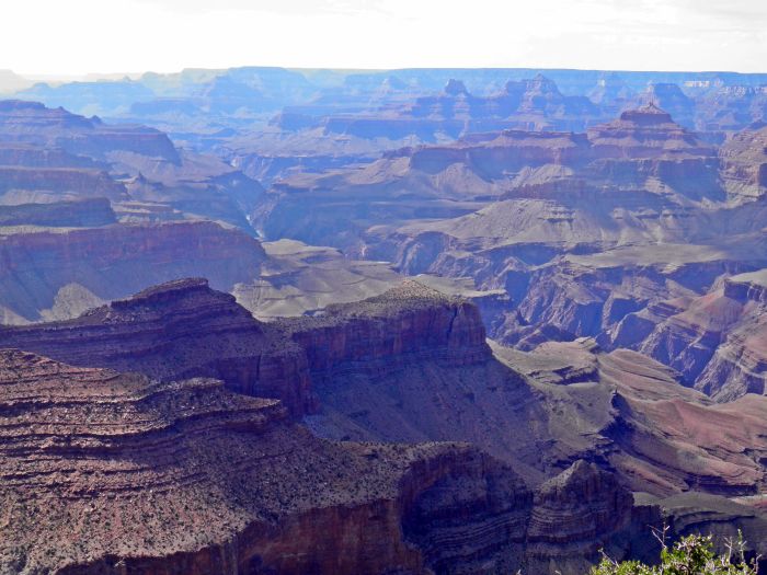
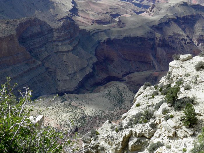
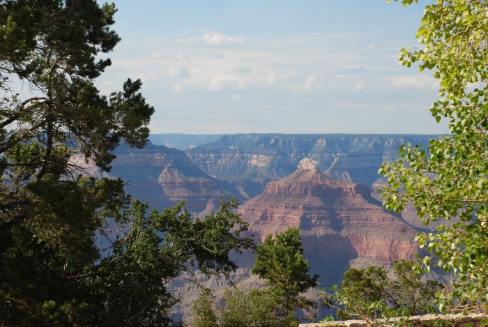
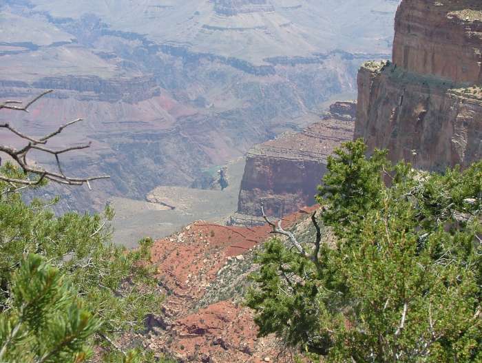
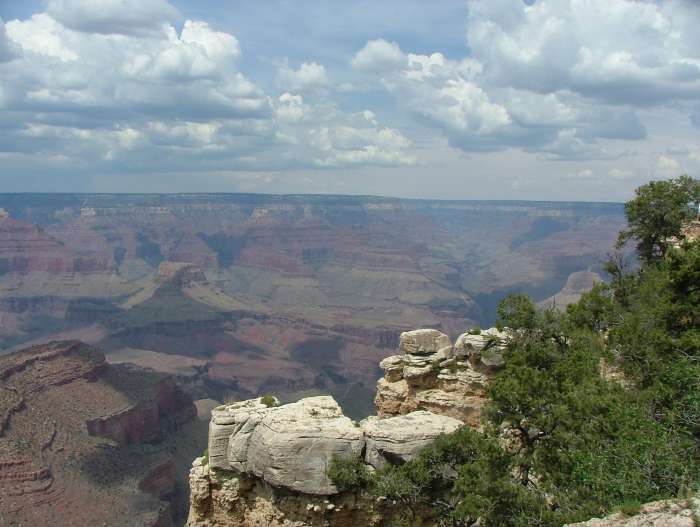
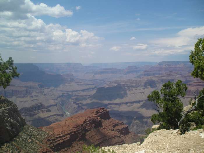
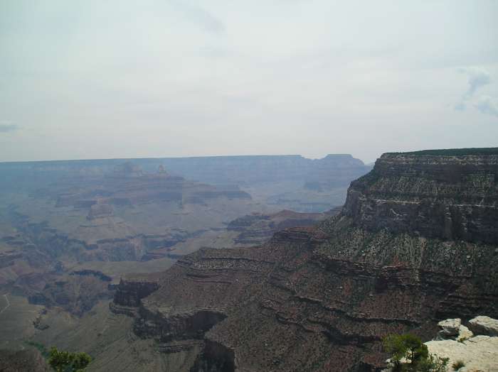
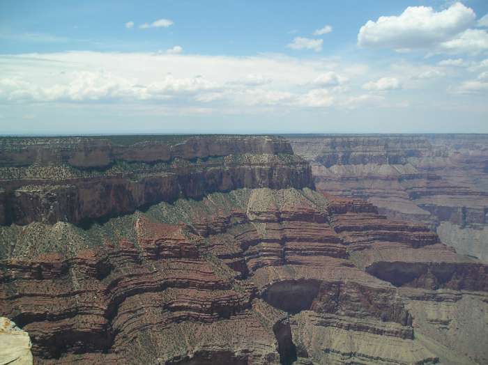
It is impossible to do justice to the Grand Canyon in pictures. It must be experienced. When we visited the place, there were some haze, that did not make it easier catch the true erxpirience, but enjoy the following pictures anyway. |
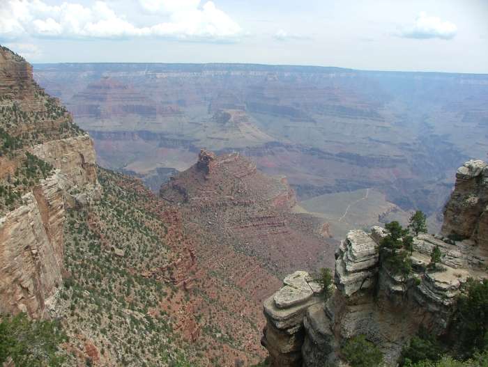 |
It is hard to describe the pictures, so I think that I just let them speak for themselves. |
 |
|
 |
|
 |
|
 |
|
 |
|
 |
|
 |
|
 |
|
 |
|
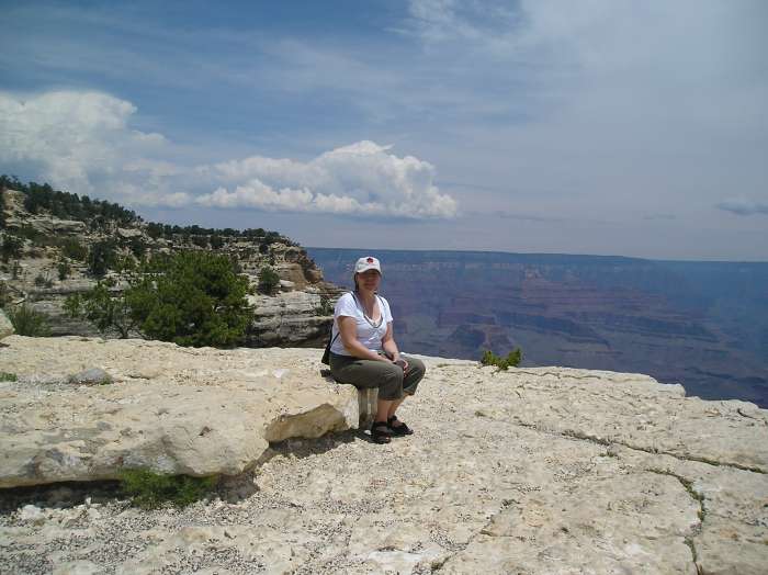 |
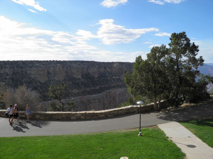
We walked up and down a lot in the 2,100 meters altitude, so sometimes it was nice to have a rest. Notice that there are no railings. It is people's own responsibility, that they do not take the one step, 5,000 feet stairway down to the bottom of the canyon. |
 |
Occasionally the path was very close to the edge, but actually it is an amazing few who actually fall down. Most who die in Grand Canyon, and it is some each year, die from overwork because they underestimate how difficult it is to get into, and especially up from the canyon, and thus overestimates the their own physical condition. Most of those who die are young men between 20 and 30, which are in good shape - just not good enough. |
 |
Although the canyon is very beautiful, we nonetheless had time to enjoy other things as well such as the varied vegetation. Here are some small cacti. |
 |
Along the canyon are hotels and most of them have rooms right on the rim. |
 |
In this picture you can see El Tovar Hotel, who was the first hotel built in Grand Canyon Village way back in 1905. |
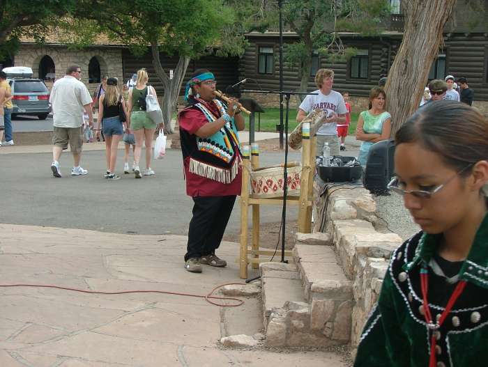 |
Next to El Tovar is Hopi House, and here happened to be an appearance of Navajo and Hopi dancers, as we passed. The musician is playing for the dance, as a female dancer is leaving the place. |
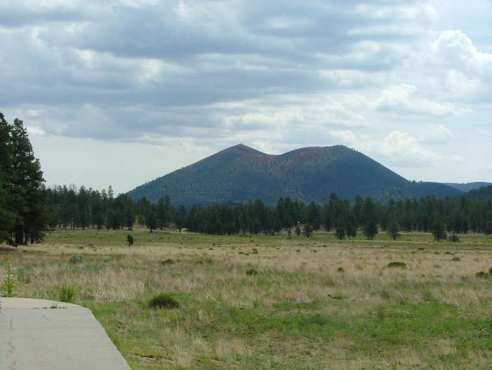 |
North of the city of Flagstaff you find Arizona's highest mountains, the San Francisco Peaks, and not far away is the probably extinct volcano Sunset Crater. The volcano does not look like much, but it is actually 2,451 meters above sea level. When it does not appear larger, its due to the Colorado Plateau it self being around 2,100 meters above sea level. The volcano last erupted in the 1300s. |
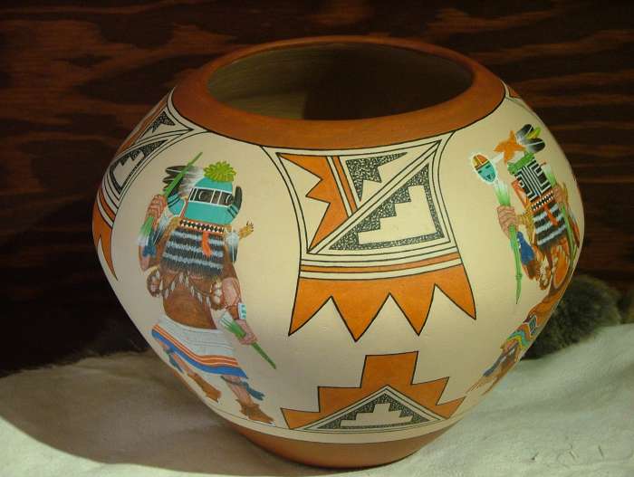 |
Not far north of Sunset Crater you enter the Navajo Reservation. In the town of Cameron are several shops selling Native American crafts, and here we found this beautiful pot. Unfortunately the price was a little to high at $ 1,300, so we decided to leave it and settle for the picture. |
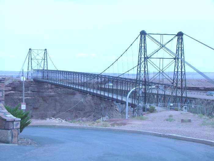 |
This bridge is on the outskirts of Cameron, and on the other side of the bridge you enter the northwestern part of Painted Desert. |
 |
Painted Desert takes its name from the many colors the rocks and desert sand has. Colors are changing with the weather, and with the sun, so you can visit the same place several times and each time see it as new. |
 |
Painted Desert is in its own way just as impressive and just as beautiful as the Grand Canyon, although this area seems much "softer". |
 |
Personally, I think that the Painted Desert made a bigger impression on me than the Grand Canyon, mostly because Painted Desert was a surprise. Grand Canyon, I've seen many times on film and in television, so here I knew what I had in store. |