A short walk along the rim
At the
south rim of the
Grand Canyon is established three free bus routes in order to
 minimize
car traffic.
One (blue route) going around within Grand Canyon Village between hotels and
cafeterias, supermarket, camping, etc. A second (green route) runs in an
easterly direction along the canyon to the east entrance and the last (red route)
runs west from the village along the canyon rim.
Via the blue route, you can travel between the two other routes that do not meet.
Our plan for the day was to take the red route and we would like to go early so
already 7.15 AM we were ready to leave the hotel.
We chose to go the approx.
800 meters from the hotel to the final stop of the red route, and here we got on
a bus just after 7.30.
Red route has eight stops at viewpoints along the canyon. We took to the last
stop,
"Hermits Rest." about 7 miles from the village.
At the final stop, we left the bus.
Here we found a small shop where we bought some water.
Then we walked about
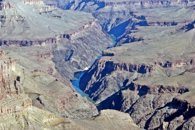
1,100 yards further west along a small path and enjoyed the view over this part
of the canyon, which none of us had seen before.
(Tim had not seen anything other than what we saw the previous day). When
Dorte and I visited four years earlier, we arrived by train, and there was not
time to go very far from the village.
After looking at the canyon, we went back to Hermits Rest and took the next bus
back east.
I had unfortunately forgotten that the bus stops at only 3 places on the return trip, so you should actually visit all the stops on the way out - if you want to
see them all.
Now we left the bus again at Pima Point (the stop after Hermits Rest).
Here we walked around and took lots of pictures.
Then we took another bus, this time to Powell Point.
During the bus ride we spoke with a family from Colorado who visited the Grand
Canyon for the first time.
As usual they were very interested in where we came from and what we liked about
America and the Grand Canyon especially.
At
Powell Point, we left the bus again and took some more pictures.
The time was now around 9.30 and many other people were now lured to the
viewpoints along the rim.
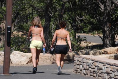
We decided to walk back to the hotel, a distance of about 3 miles. The
path was right next to the canyon rim most of the way, one of two feet from the
one-step, 5,000 feet staircase.
Later, we were actually told that the day before we arrived, a person fell down
the canyon, but over on the north rim.
We
did, however, make the trip without incidenst.
 The
rim of the Grand Canyon (south side) is more than 6,000 feet above sea level, so the
air is somewhat thinner than we are accustomed to.
Luckily we had time to get used to the thinner air in the Petrified Forest, also
located in a nice height, and in the high-altitude cities we had visited. For instance, Williams is also in the 2,000 meters and also at Sunset Crater, we
were above 6,500 feet.
Around
10.30, it had become pretty hot and the path went up and down hills, so we were
quite sweaty, when we were done. We found it
amazing how few people we met on our walking tour.
Most people apparently take the bus back and forth.
Only when we got rather close to the village we began to meet more people.
When we got back to the hotel, Tim ran an errand to the room while I continued
to El Tovar Hotel.
Not far from the hotel is Verkamp Visitor Center, one of the park's many such.
In a "park newspaper" we got when we entered the park, I had seen that at
11 AM a rangerguided walk along the rim should start from this Visitor Center, so I
sat down on a bench and waited until Tiom caught up with me. Then we followed
the ranger on her 2 mile walking tour.
We did stop in different places, where Ranger Maggie talked about the park's
geology, climate, flora and fauna and its people, not least from a historical
point of view.
It was very interesting and instructive.
Among the things we were told was how the canyon had been formed.
Maggie taught us a rhyme to remember, so we would always remember the four
elements needed to create such a canyon.
Deposition (sediment) Uplifting (rock offset) Down Cutting
and Erosion. If you just remeber the
word DUDE, you had completely mastered it.
 About
6 million years the river used to create the canyon, which is very short time in
geological terms.
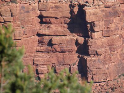
The youngest rocks are about 270 million years old and the oldest found in
the bottom of the canyon is about
2 billion years old today.
About wildlife, we heard that the most dangerous animals in the park (as
measured by number of injuries treated at the park's medical clinic), are the
many rock squirrels present everywhere.
Injuries occur when people try to feed or pet these squirrels (which are of
course banned).
Despite their cute appearance, the small animals are rather aggressive and often
bite the hands that feed them.
Besides their hard bite, squirrels may also be carriers of both rabies
and hantavirus.
Both are very likely fatal if not treated quickly.
Both squirrels as other animals may also have fleas that are carriers of plague,
and there are actually cases of plague in both Arizona and New Mexico each year.
The plague is the same type that ravaged Europe during the Middle
Ages, but in contrast to back then plague can be cured if detected early.
Beside from the squirrels the most dangerous animals probably are
mountain lions.
These remain, however, mostly hidden from people and Maggie said she had
colleagues who had worked in the park for over 20 years without ever seeing a
mountain lion.
Also rattlesnakes are dangerous, but these are also very shy, and she had seen
only two in her five years in the park.
And as far as she knew, there was never someone who had died of rattlesnake
bites in the national park history.
At the last stop Maggie told us about the people who had previously lived in and
around the canyon, from paleo Indians who lived in the area about 12,000 years
ago to the people who live there today.
We heard about their lifestyles and how they (formerly) made clothes, shoes and
other equipment of plants such as yucca palms and agaves.
 We
also heard about trips down the canyon and how exhausting it was to get up again,
and how much water you needed.
Maggie, who was a little trinket, said she used to drink about
4 liters of water on a trip down and 8 liters when she had to walk up again.
As a descent from the brim to the bottom takes you
through five different climate zones, from alpine highland climate at the top to
the subtropical desert climate in the bottom, this is a big challenge, and if
the temperature is 77 degrees centigrade on top, it can easyily rise to 105 at the
bottom. The day we
arrived a young man was found dead at the Bright Angel Trail.
It was believed that he had defied the warning, never to try to go down and up the
same day and that he had died of overwork and dehydration.
When
the tour was done, we went back to Bright Angel Lodge and the restaurant here to
get some lunch.
Then we went back to the room and relaxed for 1,5 hour to about 14.30PM.
Then we went down to a former photo studio, now exhibition hall (Look Out Studio),
where at
15 PM
we
could hear a lecture about the park's Californian Condors.
It was very exciting and we learned to distinguish between the three larger
birds, found in the park, ravens, turkey vultures and condors.
Ravens we saw plenty of - we did actually everywhere on the trip - and we had
also seen some turkey vultures, but unfortunately we saw no condors.
After the lecture we went back to the hotel and relaxed until it was time for
dinner.
Then we went down to the restaurant again to eat.
When we had eaten we got the car from the parking lot and drove down to the
local supermarket which was about 2.5 mile from the hotel.
Here we bought some fruit and water before we drove back.
In total we walked about 10 miles throughout the day and although
it does not sound like much for a whole day, we could tell that we were at
higher altitudes than we were accustomed to.
- Return to Father and Son tour -
- Return to Travel
stories -