Billeder fra North Carolina
We've visited North Carolina a total of four times. Every time we have visited the western part of the state, the Great Smokies and Blue Ridge Mountains, but we also visited the state capital, Raleigh. The latter was not an experience that was worth writing about. Here are some impressions from North Carolina.
Click on a picture for full size.
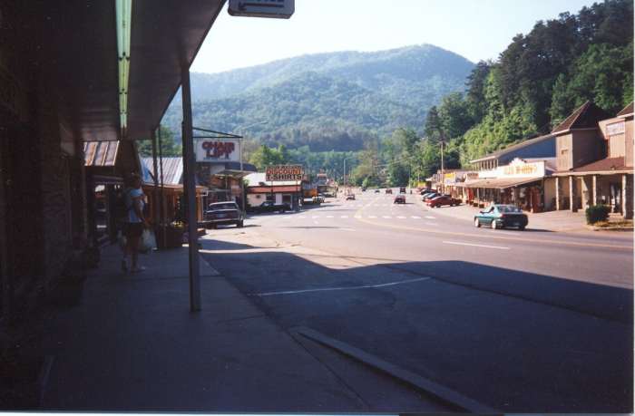 |
Two of the four times we've been in North Carolina, we visited the town of Cherokee, which is "capital" of the Qualla Boundary, home to the Eastern Band of Cherokee Indians. It was here that my interest in this tribe in particular and the southeastern native americans in general, were awakened. The picture shows the main street of Cherokee. |
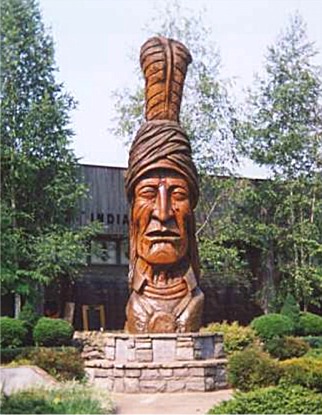 |
Outside the Museum of Cherokee Indians stands the carved statue of Sequoiah, the man who created the tribe's written language. |
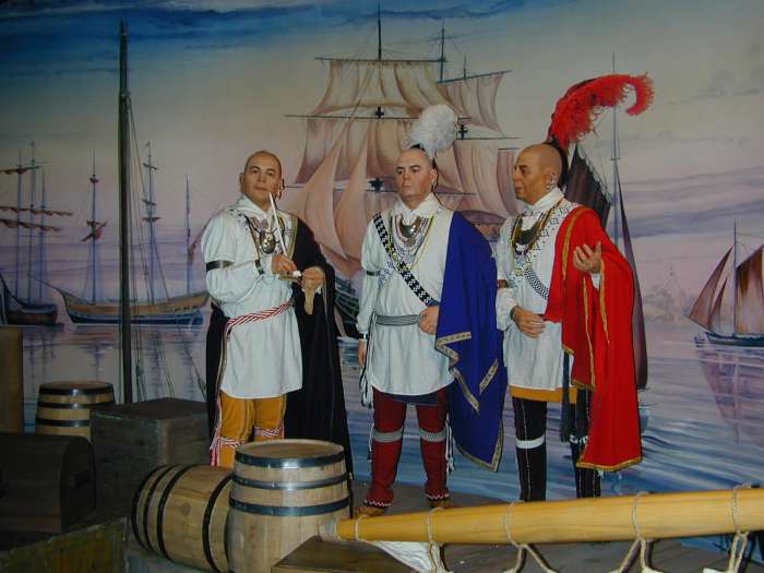 |
Inside the museum you can see exhibitions of Cherokee history. The picture here depicts three cherokees in London. Actually seven young cherokees went to London in middle of the 18th century to be presented to the king - among those Attacullaculla, later a famous Cherokee peace chief. |
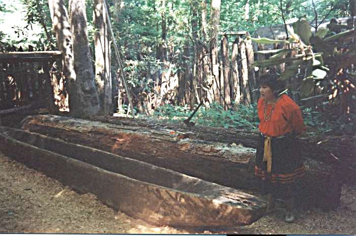 |
Just outside town is Ocanaluftee Indian Village, that illustates how the Cherokee tribe lived around 1750. In the picture canoe making is explained. |
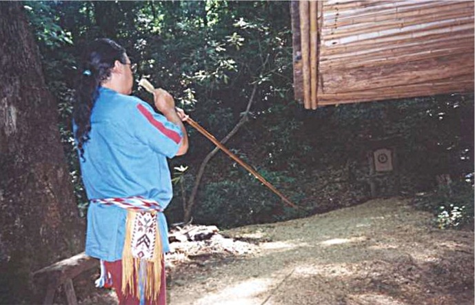 |
Blow guns were only used for bird hunting, not for war. |
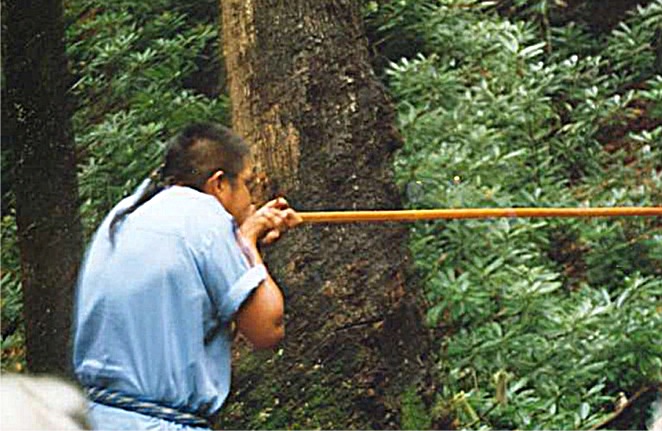 |
It is strange that you can hit anything with a 9 feet long blow gun when you have both hands where you do. |
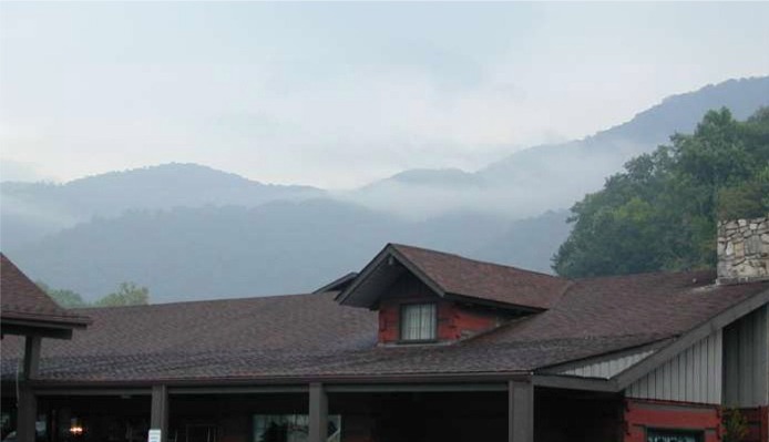 |
Cherokee is located in the foothills of Great Smoky Mountains, and the clouds are hanging low over both the city and the mountains. |
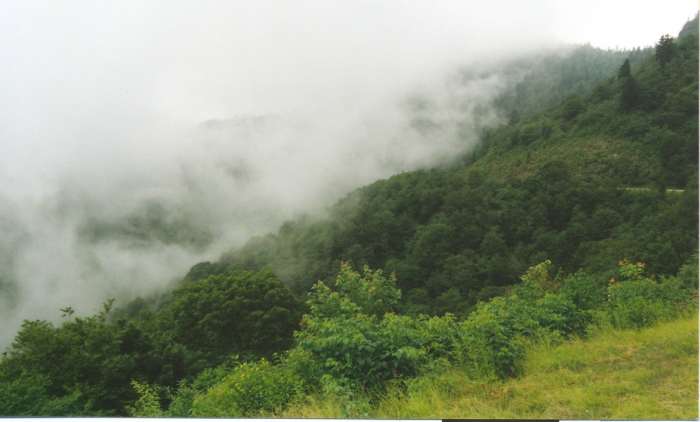 |
The Cherokees named the mountains Sha-Co-Na-Gee, which means "Place of the blue smoke" and after visiting the area, you understand why. |
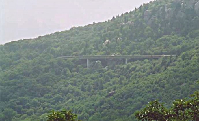 |
The Blue Ridge Parkway runs through the Blue Ridge Mountains from Cherokee in the south to around Charlottesville, Virginia, in the north. The picture shows Linn Cove Viaduct at Grandfather Mountain. |
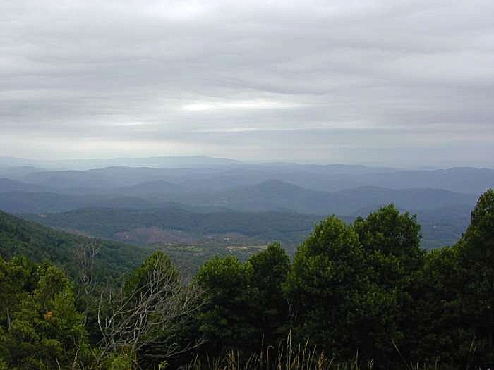 |
From Blue Ridge Parkway, you have a tremendous view of the surroundings like The Black Mountains, near Asheville. |
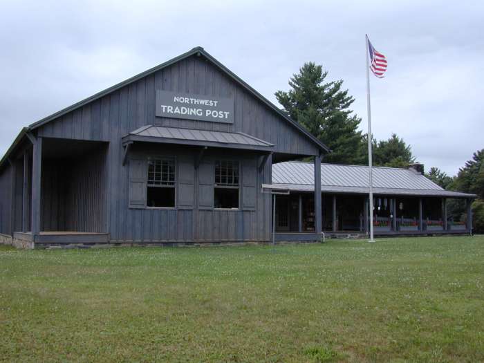 |
By the parkway, a little further north you find Northwest Trading Post, which sells crafts made by local craftsmen. |
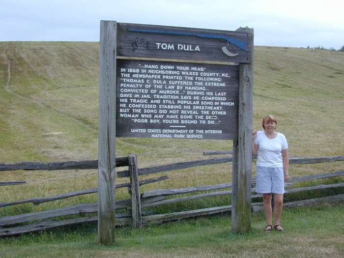 |
Not far from the trading post is the overlook called "The Lump", where you can see this sign, which served to arouse my interest in Tom Dooley. |
 |
The Tom Dooley events took place in "Happy Valley" which is part of the Yadkin River River Valley. The picture shows a part of Happy Valley, near the city Ferguson, former Elkville where Laura Foster was found murdered in 1866 |
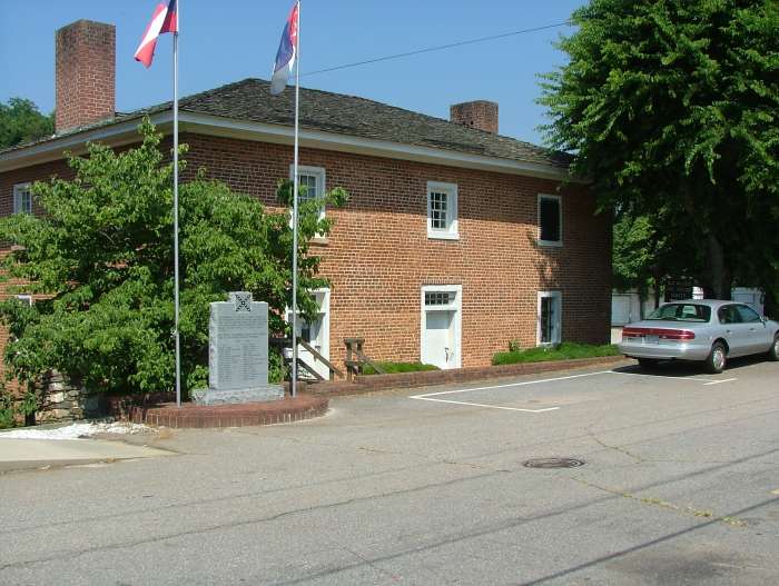 |
When Tom Dooley was arrested, he was put in jail in the town of Wilkesboro. The prison still exists, and is today a museum. |
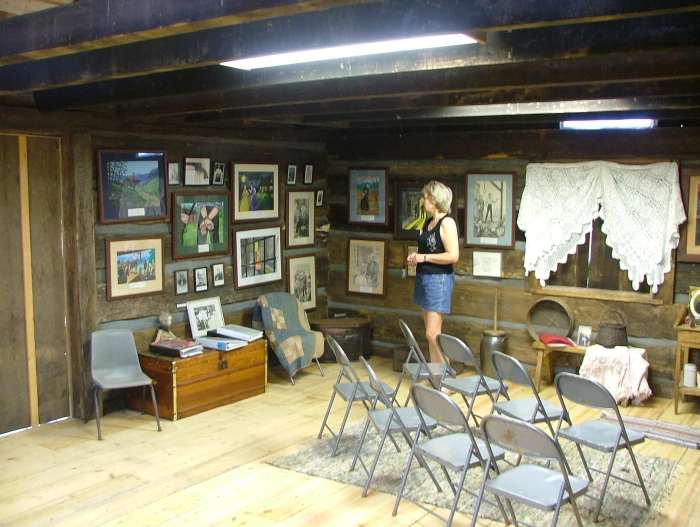 |
At Whippoorwill Academy and Village just outside Ferguson you can visit a Tom Dooley museum. The museum contains, among other things a series of effects, which belonged to Tom Dooley or other persons who were involved in the case. In addition, a number of watercolors painted by Edith Carter, as she imagines the people and the events. |
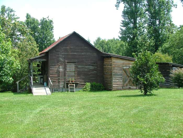 |
The academy itself is an old one-room school, as seen in this picture. |
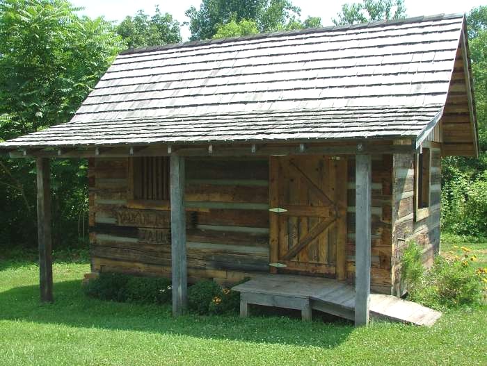 |
In the village are several other houses and cabins, including a small chapel, and a copy of the cabin Daniel Boone lived in when he lived in Wilkes County. Also the old jail from the Yadkin County (pictured). Somewhat more primitive than the prison in Wilkes County where Tom Dooley was jailed before he was transferred to Statesville for his trial. |
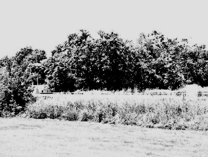 |
This, granted very poor, black and white image is from Statesville. It depicts the area where the old railway station used to be until 1911. Where there now are bushes in the middle of the picture, stood the gallows, where Tom Dooley was hanged on May 1st 1868. |
 |
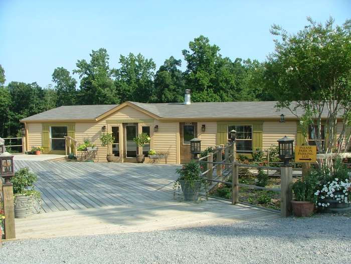
During our visit to Ferguson, Wilkesboro and Statesville, we stayed at a cozy Bed and Breakfast in Union Grove in Iredell County. "Madelyn's in the Grove" was the name. |
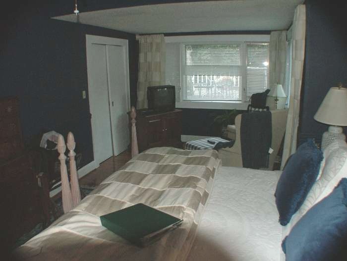 |
The room at Madelyn's was extremely nice, with a very high and soft bed |
 |
Our hostess, Madelyn Hill, suggested that we spent the afternoon visiting som Swan Creek some wineries, so we did. Raffaldini's was one of them. |
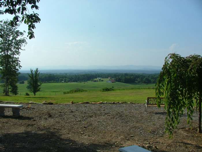 |
Madelyn had praised the view at Raffaldini, and it was indeed nice. |
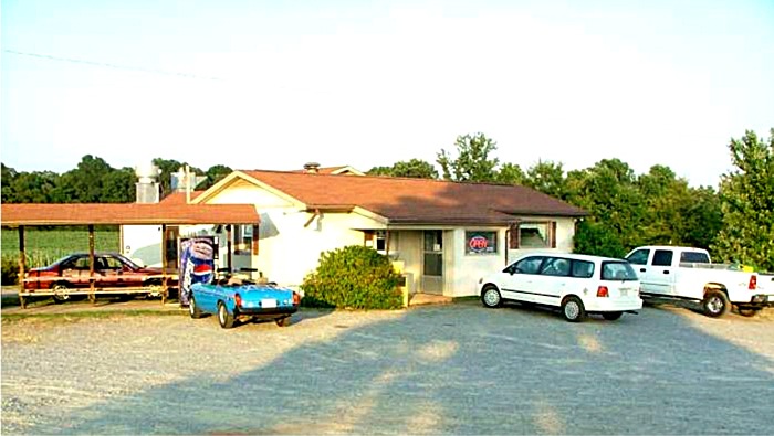 |
It was also Madelyn, who suggested that we eat our diner at the small, very remote, and extremely local Gaby's Diner on the corner of Buck Shoals Road and Union Grove Road. It gave us one of our most enjoyable experiences in the U.S. ever. I still have a pin on the address in my Google Earth. Start Google Eath and zoom in on 36o 03' 17,58" N and 80o 49' 51,12" west and see for yourself how remote this place was. Today its known as "The Korner Kitchen". |
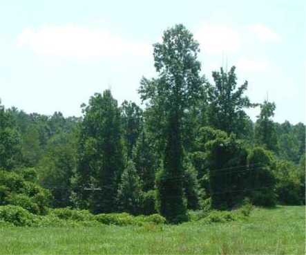 |
Also in North Carolina the invasive Kudzu thrive. It spreads over larger and larger areas in the southern states and kills all natural vegetation. |
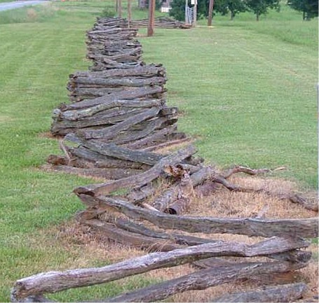 |
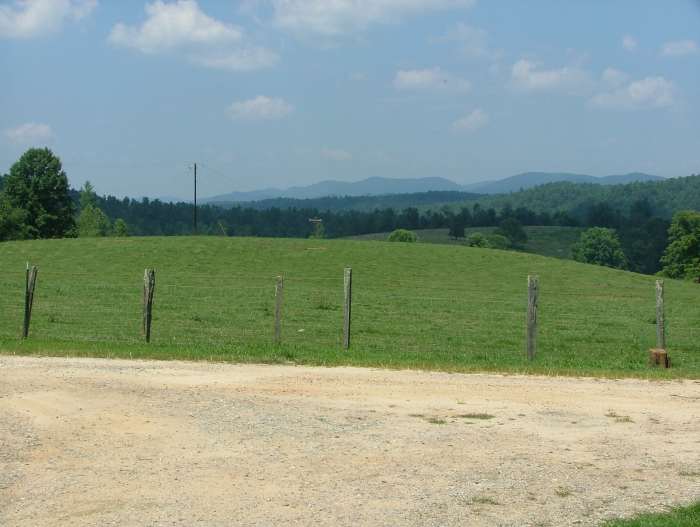
In addition to kudzu, there is another thing that is everywhere in the southeastern states, and that is wooden fences. Fences can be found in innumerable variations, here is one of them from Union Grove |
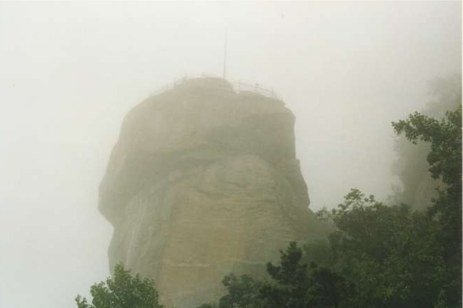 |
The first time we were in North Carolina, we visited Chimney Rock Park near Henderson, to see Chimney Rock. Unfortunately, it was so foggy that we could hardly see anything, let alone the famous view from the top of the chimney. |
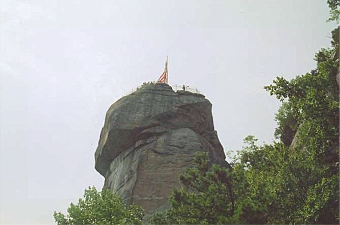 |
We therefore had to come back two years later and see it all again. This time the rock was indeed significantly more visible |
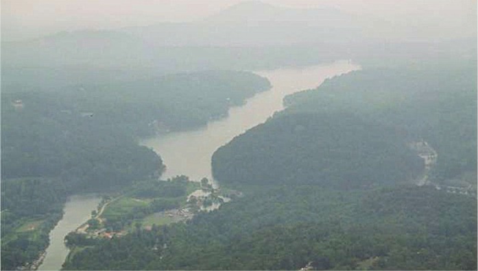 |
Unfortunately, there was so much mist when we visited, it nevertheless was so-so with the view. You could then see Lake Lure in the valley below the rock through the mist though. Grandfather Mountain, 80 miles away, which should be visible on a clear day, remain in the world of myths :-) |
|
|
The free-standing rock is about 300 feet tall. |