Big trees, Birds and Peanuts
 In 2006
Dorte and I stayed for a night in Eureka, California and the next day we took
Avenue of The Giants south. Tim would also like to see the big trees, so we
decided to take the same route - or at least almost, as we were not staying in Eureka,
but instead came from Bandon, Oregon.
Our hotel was south of Bandon, but
we started by driving north along the coast in direction of town. We wanted to
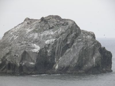
take a closer look at "Face Rock". A rock just off the coast. If
seen in the right angle the rock resembles a woman's face. Local Indian legends tell that
under the right circumstances, you can hear a
female voice singing out over the sea. The story goes that an Indian princess Ewauua,
hase been
bewitched by an evil spirit Seatka and so has her dog Komax and her cats. All of
them, including the evil spirit have now turned to rocks in the ocean.
We heard no song though, but the face was recognizable in a certain angle as
shown in the picture. We couldn't spends hours looking at the princess,
waiting for her to sing, so we left
Bandon and continued south on U.S. 101. Some miles south of Bandon, we
came to one of the around 20 towns in USA called Denmark. Calling it a town is maybe an
exaggeration. When we drove on the same stretch in 2006, Dorte wouls like to "see"
the village. When we got to the place she was driving the car, and
as I said, "Now we are here", we had passed the village. That would
change this time. Not only would we see the village, but we would also take pictures
as well as proof of our visit. Tim was driving and I kept the camera ready. However, the same thing happened
again. When I saw the sign telling that we were entering Denmark, we were far past the town.
However, I was stubborn, so we turned around and drove back. This time we
stopped and I took a picture of the city sign and one of a signpost with the
name of the
only road in the village, Denmark Lane and also the only house that was visible on the road.
It's probably
the smallest town we've ever visited. Back home I made a closer investigation,
and I discovered that the town was originally founded by two Danes, who
established a profitable dairy
company in the area. In 1882 a post office was established, and in 1915 the
village had a sawmill, a cheese factory, a dairy, retail shops and a school. In 1940
the village still had 96 inhabitants.
 In 1960 the post office closed and in 1990 the only business left was a gas station. In 2009, the station also had a Drive-In
Espressobar, but it was closed when we were there, and nothing much happened in town.
We stopped a few more places
along Route 101 to take pictures, and at Cape Blanco, we left
the highway to go to the cape with its lighthouse. In 2006, it was very windy
and cold out there and it was even worse this time. When we stopped in the
parking lot, Tim, was in the winward side of the car,
and he almost couldn't open the door, and when we finally both got out, we were almost blown away.
At the same time the temperature was the lowest we had experienced on the
trip (around 45 degrees), and with the wind
chill factor it was probably down around freezing, so we quickly got back into
the car and left the ocean to return to the highway.
Tim wanted to get close to the Pacific, so after passing Port Orford, we tried to find a
suitable place to stop.
I could remember that Dorte and I had eaten lunch at the beach somewhere south of
Port Orford, and we found the place this time too. However, the rest area was closed
due to roadworks, so we had to drive on. We then found another place where we
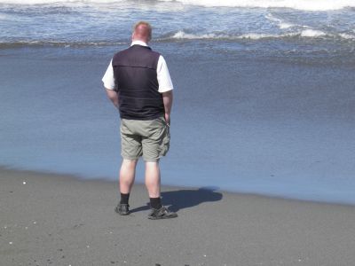
could get down to the beach though. He we saw a few people fishing from the
coast, but what
they caught, I dare not say - if they caught anything at all. So after Tim had
seen the ocean, we continued south along Route 101 to the
California border.
In the town of Crescent City, we ate lunch and then we continued into the
Redwood National Park, where you do not pay entrance fee so we couldn't use our
Annual Pass. The
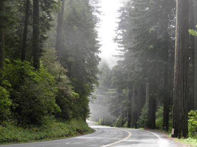 park is known for its
large redwoods, and here you will find (if you know where to look), Hyperion. With its
380 feet it is considered the
world's tallest living tree. The tree stands in a desolate part of the park, which
is only accessible
by foot and its actual location has not been made public. We however saw plenty of other big trees that were all very
impressive.
In Eureka, we made a short stop so Tim could get a glimpse of the many
quirky, Victorian houses. Not least the Carson Mansion with its many gables and
turrets and several other houses in the same area. We continued
south along Route 101 to the small town of Pepperwood. Here we changed to
California Route 254, also called Avenue of the Giants (our main goal of the day) to look at more and
larger trees. En route we stopped quite a few places, among others at Immortal
Tree, where there is a small giftshop. I bought some carved wooden bears to take
home, and also some bookmarks made
of bark from the Redwoods.
A little further south, at the Founders Grove, we
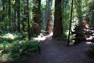
made a longer stay and went for a walk in the woods. Here we visited the
Founders Tree, which is a "dwarf" of only 346 feet in height and 12.7
feet in diameter. The lowest branch is 190 feet up the tree. We also visited several
hollow trees which could be entered - and so we did. There were
many fallen trees in the area, among other The Dyerville Giant. When this tree toppled in 1991 it was the world's
tallest known
tree with a height of 372 feet. The tree was about 1,600 years old when
it toppled with a big bump. The tremors were felt more than a mile away. The tree
is so large that it is believed that it will take between
 300 and 400 years
before it decomposes.
After the walk, we continued south along Avenue of the Giants without further stops.
It was getting late, so we decided to stay for the night in Garberville south of the park, but
when we got there, we couldn't get a room. We therefore continued along 101 to Leggett, but
in this city, we could not even find a hotel. In Leggett California Route
1 has it northen terminus. It's the state's most famous road and one of the most famous throughout the USA.
We therefore decided to take this road to the coast, and then see
if we could not find a room in one of the many coastal towns. What we hadn't foreseen was that the road was
very winding on it's way to the coast, if possible, even more than Oregon Route
242, that we took the day before. In fact it was so twisted that we turned on the
GPS reciver to see the turns in better time than by looking out the windshield. It was
absolutely impossible to drive more than 30 to 40 miles an hour,
and only then we got to the coast and the road straigthened, we could pick up
speed.
When we reached Fort Bragg, we found a hotel and stayed there for the night.
From Fort Bragg we would continue south along the California coast to Bodega Bay and then head inland to Santa Rosa.
When we left the hotel which was located in the north end of Fort Bragg around
9 AM, we drove south through the town. In 1857 a fort was erected to "protect"
the mendocino indians.
The commander of the fort, Lieutenant Gibson, named the fort after his former
commanding officer, Braxton Bragg, who would later become a general in the Confederate Army during the
American Civil War. Only one of the fort buildings still exist, and we passed
that on our way out of town, but we did not stop. We continued along the coast
along California Route 1, which at first was wide and with a speed limit of 65
mph, but soon got just as winding as the previous day.
CR1 meanders along the rocky coast, often right at the cliff with a 300 feet
drop down to the Pacific. Although the stretch along Big Sur south of Monterey is
more famous, this part of the road was as scenic and exiciting as the southern
counterpart. As the speed limit was low, there was time to enjoy the
beautiful scenery. As we drove south, we passed many rivers flowing into the Pacific along
the California coast, among others Garcia River and Navarro River. As we
approached the latter, there was s dense fog, but fortunately it lifted again. Otherwise,
we probably had to slow down further.
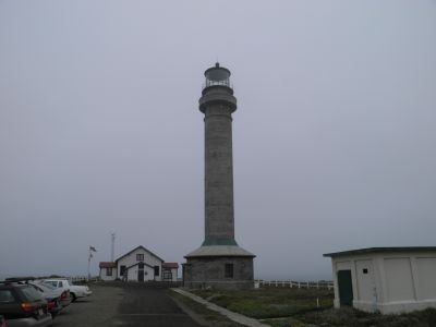 Just south of the Navarro River
is the small town of Point Arena (only 474
inhabitants), known partly for its lighthouse and partly because the
San Andreas Fault leaves land and continues under the Pacific. We chose to visit the lighthouse. We started
our visit at the former home of the lighthouse keeper, where there is now
a souvenir shop - and a museum or maybe vice versa. Here we bought a ticket so we
could climb the lighthouse, but before we were allowed to climb the 147 steps
we had to see the museum and have a lecture by an older gentleman who
proved to be a very exciting storyteller. He talked about the first lighthouse,
built in 1870, which was almost completely destroyed in 1906 by the same
earthquake, which also ruined most of San Francisco. The current
lighthouse was completed in 1908, and was equipped with an oil lamp, which,
reinforced by a so-called Fresnel lens weighing 2 tons, could be seen at a distance of
17-18 nautical miles (20 miles). The lens was rotated by a clockwork, drawn by a
pendulum that "fell" down through the tower and the lighthouse
keepers had to rewind it by hand every
five minutes. Rewinding took approx. 10 minutes. The lens rested on a layer of
mercury to reduce friction and wear and tear when turned. The oil lamp was filled every four
hours, and the wick should always be trimmed. It was hard work being a
lighthousekeeper in those days and beside the keeper, three lighhouse workers
lived
at the lighthouse. Later,
the oil lamp was replaced by two electric 1,000 watt lightbulbs and an engine
was installed to turn the lens. But today also this is removed from the
lighthouse.
After the lecture we were allowed to climb the stairs to the lighthouse,
together with an elderly
couple who had come by while we waited. At the top we were greeted by a young
man, who then told us about what we could see from the top of the lighthouse.
Unfortunately it wasn't much, as the fog had reappeared, albeit not as
dense as before. We saw, however, some sea lions on the rocks far below and
a single turkey vulture. The young man told us that the ships do not come close to the coast and also has satellite navigation, so the
lighthouse had outlived its usefulness. Today, all that is left is a tiny projector
with a lens, mounted on the gallery around the original lens room. The whole thing
weighs just 20 kg and can be seen about 14 miles away, and is used
almost exclusively by fishermen and boaters. Moreover the lighthouse is equipped
with a radio beacon with
a range of approx. 50 miles and a radio buoy is anchored in the sea off the
lighthouse. After the visit we returned to the museum and visited the
souvenir shop, but without buying anything.
 After the visit, which lasted approx. one hour, we
drove back to the highway
and continued south. Further south we passed Fort Ross. It was originally built by Russian fur
trappers in the early 1800's. Many Russian fur trappers came to the North
American coast from Alaska, who was then Russian, and they settled on much of
the coast from Washington to northern California. Fort Ross was the
southernmost Russian defense post. Unfortunately, the fort was closed when we
got there,
so we made do with seeing it from outside.
At Jenner we passed another river, namely the Russian River, which has been
named for the many Russians who lived in the area sometime. From there we drove
on
to Bodega Bay, a town of about 1,400 inhabitants, which is probably best known
because it was here and in the even smaller inland town, just called
Bodega, Alfred Hitchcock filmed his thriller "The Birds". Also, this town was founded by Russians in
1809. They called it, however, Port Rumyantsev named for the then Russian
foreign minister. We ended our trip south and drove east into the
country to Santa Rosa, via yet another Russian-inspired city, Sebastopol. On
this short trip (approx.15 miles) the fog disappeared, the sun came out and the
temperature rose considerably to about 85 degrees.
We had decided to stay in Santa Rosa, but when it was only 1.30 PM when we reached town, we agreed to
have some lunch and then go to a museum
before we started looking for a hotel. More precisely, we would visit the
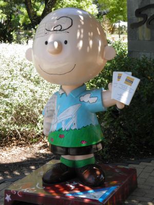
Charles M. Schultz Museum. For those not familiar with Schultz, he was a cartoonist and even more accurately, he was the originator of the
world's best comic of all time (in my humble opinion), Peanuts.
Schultz died on February 12th 000 after having created strips every day
for more than 50 years. The last strip was brought in the world's newspapers
on February 13th, as Schultz had requested that no one should continue his
series. Schultz had lived much of his life in Santa Rosa, and here they have
thus created a museum for him. Of course there are plenty of "peanuts" at the
museum, but also many other comics, as Schultz has been inspired by or have
influenced, and of course there are also many other things from his life, like
his many golf trophies, his office mm. We spent about two hours at the museum
and then we found a hotel which was close by.