Eating Dooley-style
Wednesday. The last day before we were to head north to Dulles Airport. We could do the trip in one day (I did that without problems in 2013 and 2015), but we had decided to do at least a little sightseeing along the way. So we had one last day to spend in western North Carolina before that.
Our first goal of the day was a visit to my favorite winery in North Carolina and maybe in the whole of USA, Laurel Gray, 20 miles west of Wilkesboro. Their wines are good, and even excellent in some years, the owners and their employees are friendly and nice to chat with, and they make a splendid barbecue sauce, that especially Tim loves. Along the way we looked up another winery, Rafaldini. Not to buy wine, but because Tim wanted some pictures of the Italian style villa, that is the home of that winery.

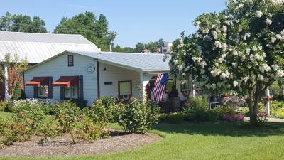
The tasting room at Laurel Gray is housed in converted milking parlor from the 1930s.
Laurel Gray Vineyards is situated on Old US Highway 421, but for some reasons both Google Earth, Google Maps and our satnav insisted on placing it on Highway 60. That was really strange as US Highway 60 is not even in North Carolina, and North Carolina Highway 60 is more than 200 miles away from Laurel Gray and don't even get close. It didn't matter much though as we had visited the place several times and knew exactly how to find it.
When we got there, three people were busy tasting the products, so we looked around until they were done. When it became our turn the employee taking care of the tasting, recognized me from an earlier visit (in 2013), and I recognized her, even if I didn't remember her name, but she told us that her name was Johnny. We also learned that the owners, Kim and Benny, were not present. Benny was busy with the wine production and Kim was busy looking after her grandchild! We did the usual tasting, and as always spent too much money buying wine, barbecue sauce and other edibles. As usual we refused the wine glass that is included in the tasting, as it would be almost impossible to transport it back to Denmark. Along the way we asked Johnny about the strange address the maps knew for the place, and she told us that nothing had changed, except for the mapmakers ability to get the address right. This is of course not the only place where the maps are wrong, not even in this area. The map on Google Maps and also Google Earth (strange?) insists on Tom Dula Road in Ferguson being NC Road 1134, even if street signs at the place clearly shows that it's NC 1164. For some reasons that I don't know, the street sign has been removed from the Earth View pictures.

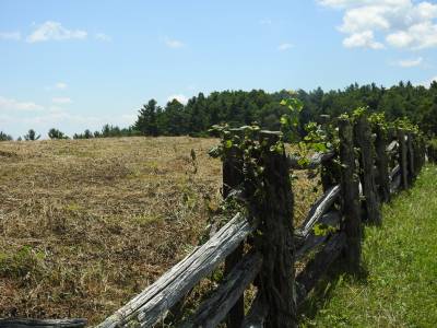
Fence near Northwest Trading Post
After the visit to Laurel Gray, we headed west on US 421. We passed Wilkesboro and continued to Boone, county seat of Watauga County, 50 miles west of Laurel Gray. Boone is named after famous hunter and explorer, Daniel Boone, who lived in Wilkes County at one time of his life and passed through the Appalachians on several occasions. Boone is considered to be a hero, but I don't like him!! He was the one guiding the Englishman Richard Henderson and his company across the mountains to Sycamore Shoals, where he (Henderson) signed an illegal treaty with some Cherokee chiefs, that allowed him to buy Cherokee land in Kentucky and Tennessee. This caused the 18 year long Chickamauga War (1776 to 1794)between the Cherokees and the Americans in the area. And I blame that solely on Boone J. By the way, Boone is the only town east of the Mississippi River with an elevation more than 3,000 feet (3,333) above sea level and a population of more than 10.000 people.
The reason we drove to Boone was neither it's elevation nor it's population, but to get on The Blue Ridge Parkway and so we did. We started heading north on BRP, to visit Northwest Trading Post. Here you can buy works of local artisans, musicians and of course an occasional souvenir. We bought some locally made natural soap to bring home to our older female relatives and some hot sauces for ourselves. While there I went outside and photographed some of the traditional fences that the Appalachians are known for. Then we turned south. Along the way we made a short stop at the outlook called The Lump. This is where my interest in the Tom Dooley was aroused back in 2002. We continued south, passing Boone once more. For the first time on this trip, we met a road work, about a couple of miles long and controlled by flag men, who are not actually using flags, but signs with the text STOP on one side and SLOW on the other. We got some nice pictures of Linn Cove Viaduct carrying the road around Grandfather Mountain. Tim wanted to visit Grandfather Mountain State Park until he discovered the prize for walking the mile-high swinging bridge, then he refrained.
A few short miles after having passed the viaduct, we left Blue Ridge Highway to pay a visit to Linville Falls. When we got there it was mid aftermoon, and as the temperature was 100 F and the humidity also around 100, we decided not to walk down to the falls, but took a shorter and not so steep path to a much smaller, but still nice fall. At least it would have been, if the parents around had been able to control their children and prevent them from screaming loud right next to the signs asking for silence, so the rippling of the water could be heard. After our visit we headed for Banner Elk so I could show Tim the eyesore they have built on a the top of Sugar Mountain in the form of a big, cubic condominium building, that completely spoils the view. We continued back to Wilkesboro, with a short stop at Mount Pleasant Baptist Cemetery near US 421 between Boone and Wilkesboro. This was where I spent 45 minutes in 2015 in 40 degrees F, wearing only a shirt and shorts, looking for a the gravestone of James and Celia Scott, but with no luck. This time though we managed to locate the stone, with the help from a picture and Tim's internet connected cell phone. So this time I got the pictures I wanted. From there we returned to the hotel, and rested for a couple of hours before going out for some dinner.
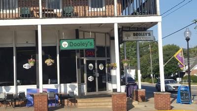
 Dooley's
Grill and Tavern in the old Smithey Hotel building. A historic building
from 1891.
The day before we had decided to have dinner at Dooley's Grill and Tavern in downtown Wilkesboro, so we drove into town and parked the car. The restaurant was quite nice with old photos from Wilkesboro decorating the walls, an old-fashioned bar with lots of kinds of beer. And the menu was packed with Tom Dooley reminders like Dooley Burger, Laura Foster French Dip, Hangman's Rate Roast Beef, Executioner's Choice, Go to Jail Dooley burgers, Stuffed Dooley's Burger Sub and so on. They know how to exploit the local folklore J. On the walls were also pictures of Tom Dooley, Ann Melton and Laura Foster and a poster explaining about the case (folkloristic style). We ordered our dinner from the pleasant waitress and also a beer, a or rather two different local beers, which both proved to be excellent. When we visited The Fountain of Youth in Florida (see the article Heading for Florida by pirate ship) I had two cups of the rejuvenating water, and it must have done wonders for me, because before we could have our beers we were asked to show ID, which I found a little strange, me being 63 and usually looking so! I guess the water had me looking like the 17 year old, that I feel like inside J. Tim had a burger, I don't remember which and I had a Tom Dooley's Club, which was an ordinary club sandwich with turkey, ham, bacon, mayonnaise and mustard. The name though made it just that little bit better though J. Both courses were good and plentiful, so as usual I couldn't finish my food. After dinner we returned to the hotel, and made ready for next day's trip north.
- Return
to Long Bridge Trip page -
- Return to Travel page -